Share this article
NASA satellite data paints picture of Southwestern wildlife
When most people think of NASA, they think of its space sciences wing. But researchers recently used satellite imagery as part of NASA’s earth sciences division to learn about the relationships between plant productivity and wildlife.
In a study published in Global Change Biology, researchers combined satellite imagery with wildlife survey and GPS collar data in Utah, Arizona and Nevada to help them predict the abundance of mule deer (Odocoileus hemionus) and cougars (Puma concolor) on the landscape.
“I had some questions bothering me about home range expansion with respect to primary production and climate, so it was the perfect combination of data resources,” said lead author David Stoner, a research scientist in the Department of Wildland Resources at Utah State University and a TWS member.
The satellite imagery helped him measure plant production over a larger spatial scale than he would have been able to do in the field, Stoner said. He and his colleagues expected a correlation between primary plant productivity and mule deer abundance, but they were surprised by the strength of the connection they found. The abundance of plants, they found, proved to be a very good predictor of deer abundance.
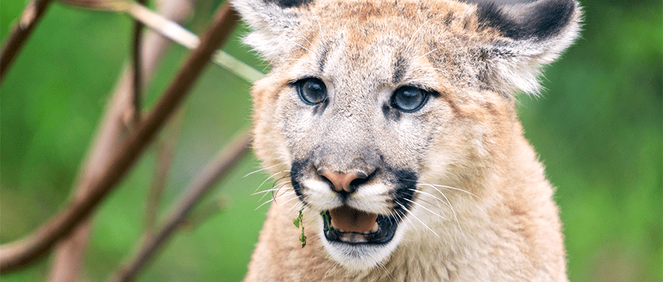
The team then wondered how mountain lion abundance, the deer’s major predator, correlated with plant productivity. What they found surprised them. “We expected the relationship to dilute or become weaker,” Stoner said, “but it was just as strong for mountain lions as it was for deer.”
This may indicate a strong, climatically driven system, he said, in which moisture and primary production limits the amount of animal biomass that a given system can support.
Because the climate is predicted to become warmer and drier, Stoner said, he expects the Southwest’s wild landscapes will hold fewer and fewer mule deer and mountain lions while irrigated suburbs and agriculture lands become more attractive.
Satellite imagery, in conjunction with field surveys, could be used to help monitor the two species, he said, especially as drought becomes more frequent, as well as to monitor other species in more remote areas where monitoring can be difficult and expensive.
NASA’s satellite archive “is a tremendous resource,” Stoner said. “It has been undervalued and underutilized by wildlife biologists.”
Header Image:
Mountain lion abundance correlated with plant production data collected by NASA satellite imagery.
©Eric Kilby
