
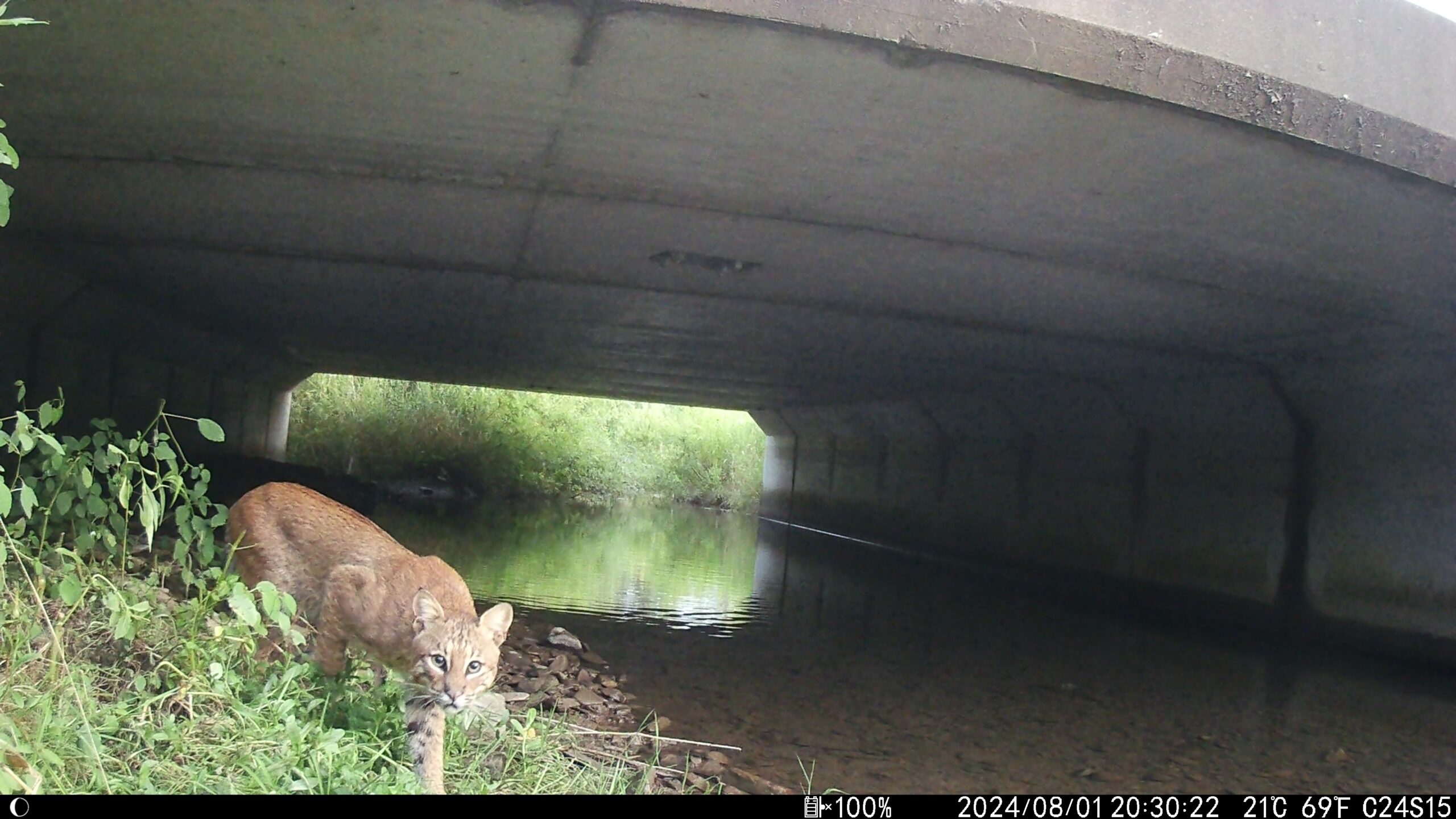
Marcus Rosten clicks play, and a video begins. The shadows and tall grasses shift under a highway bridge, and a silhouette of a bobcat appears. The feline pads softly along the crushed gravel path, hugging the water in an oversized culvert, staring at the camera as it passes.
“I was not convinced I was going to get a single bobcat photo,” said Rosten, with a mixture of awe and glee. The Director of Western New York Wildway, an initiative of the Western New York Land Conservancy, Rosten has now captured 23 videos and pictures of bobcats (Lynx rufus) across the Western New York Land Conservancy and its partners’ lands.

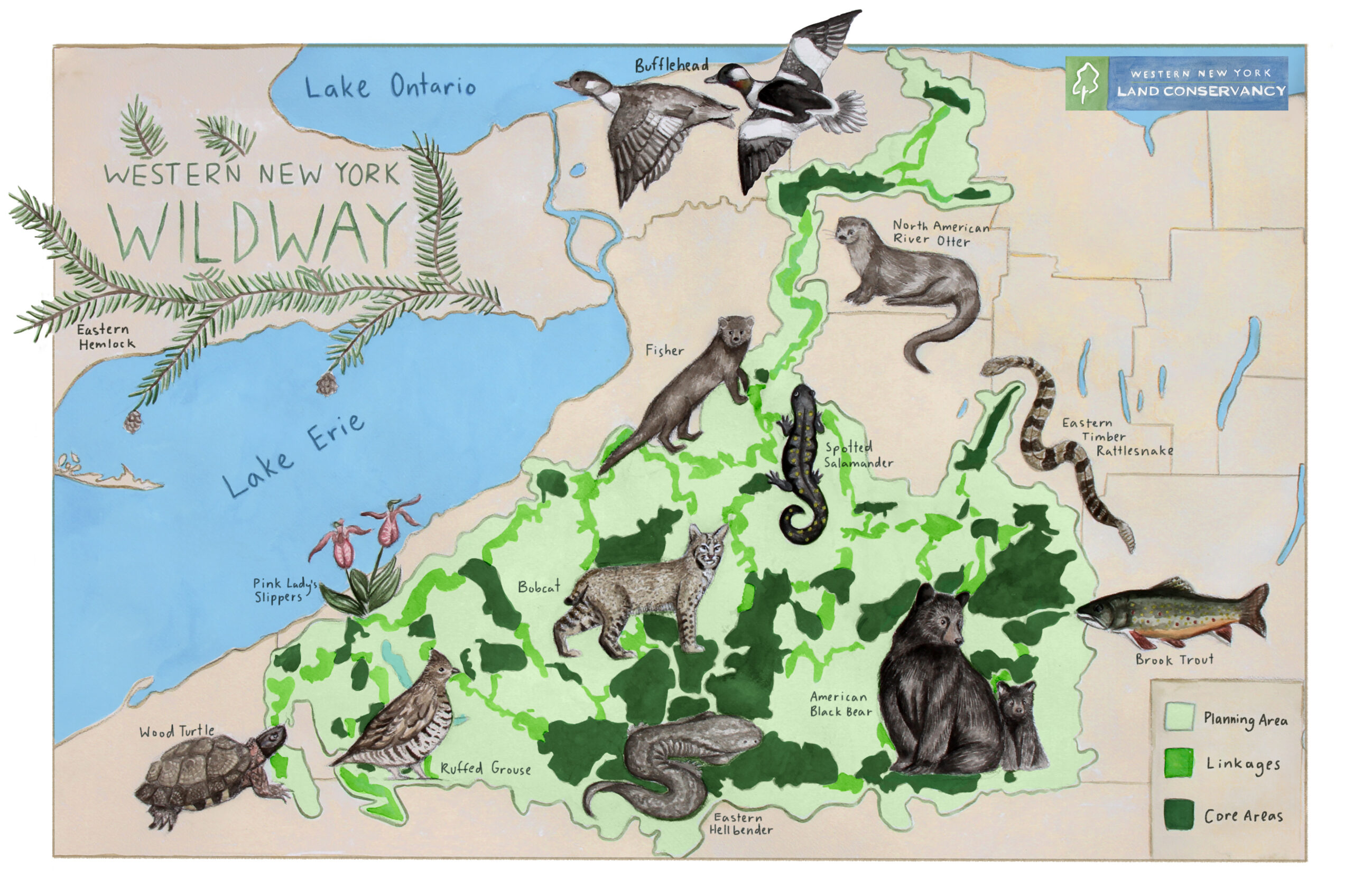
The bobcat is one of dozens of species Rosten has documented moving through protected habitat corridors and wildlife crossings that are part of the Western New York Wildway (WNY Wildway), an ambitious effort to reconnect ecosystems across the region so wildlife can move, adapt and survive despite expanding development, roads and climate change.
As Rosten describes it, wildways are both a vision and a blueprint for action. There is a vision of a larger Eastern Wildway, connecting habitat from Louisiana to Maine. Wildways link forests together to create a vital chain of connected habitat so that animals can roam freely. This connected landscape, once realized, can help sustain biodiversity and allow for wildlife movement. The WNY Wildway connects habitat from Northern Pennsylvania to Lake Ontario and across to Lake Erie, covering a significant portion of Western New York.
For our latest Q&A, TWS spoke with Rosten about how the WNY Wildway is using wildlife tracking data and habitat connectivity to turn conservation science into on-the-ground action.
How did the idea for the Western New York Wildway take shape?
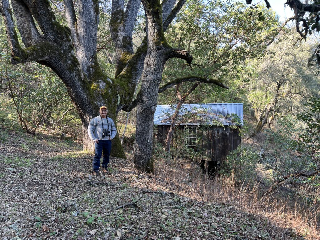
I’ve been involved with the Western New York Land Conservancy for about six or seven years. I’m a Buffalo native, and I’ve worked across a range of conservation roles with different groups. I started as a volunteer, then joined the board of directors, and then I was hired for this role. During my time here, the conservancy started thinking more strategically about land protection in western New York. We recognized that the region’s landscape had become highly fragmented by suburban sprawl and development, extending farther outside the metro regions. The organization wanted to move beyond protecting isolated islands of habitat and instead focus on connectivity. We started to ask: How can we be more strategic with land protection? We mapped the region’s largest remaining intact habitat areas and identified ways to connect them through existing natural lands to prevent that island effect.
I shifted from being on the board to working as a staff member to help turn the plan into a reality. What excites me about this project is that it brings everything into a shared regional vision: a vision that connects organizations, landscapes and priorities across western New York, from the Pennsylvania border to the Great Lakes. That kind of coordination and connectivity has often been missing here, and the WNY Wildway concept helps stitch it all together into a more unified conservation approach for the region.
How have wildways evolved over time?
The WNY Wildway concept was inspired by the Eastern Wildway vision developed by the Wildlands Network, which mapped a connected habitat system along the East Coast. We localized the idea of defining what core habitat areas and corridors would look like in our region.
We used the fisher (Pekania pennanti) as an umbrella species to guide our planning, since it depends on large, connected tracts of intact northern forest. Female fishers typically require home ranges of about 4,000 acres, so the team used that as a benchmark for identifying viable core areas, while also accounting for smaller intact habitat patches and existing protected lands within those broader zones.
To build the model, we integrated multiple datasets from The Nature Conservancy and New York state’s Department of Conservation. This allowed us to identify 38 core habitat areas across western New York, averaging about 18,000 acres each. Then we said, ‘All right, how do we map out the linkages that wildlife use to navigate between them?’ So, from there, we modeled the corridors connecting those cores to identify the most likely wildlife movement routes across the landscape, creating the backbone of the WNY Wildway network.
We established the WNY Wildway Partner Network to help organize around the goal. Since launching in 2023, the partner network has brought together roughly 70 representatives from agencies, municipalities, Native nations, nonprofits and community groups, all working toward this vision.
Have you studied the WNY Wildway in action?
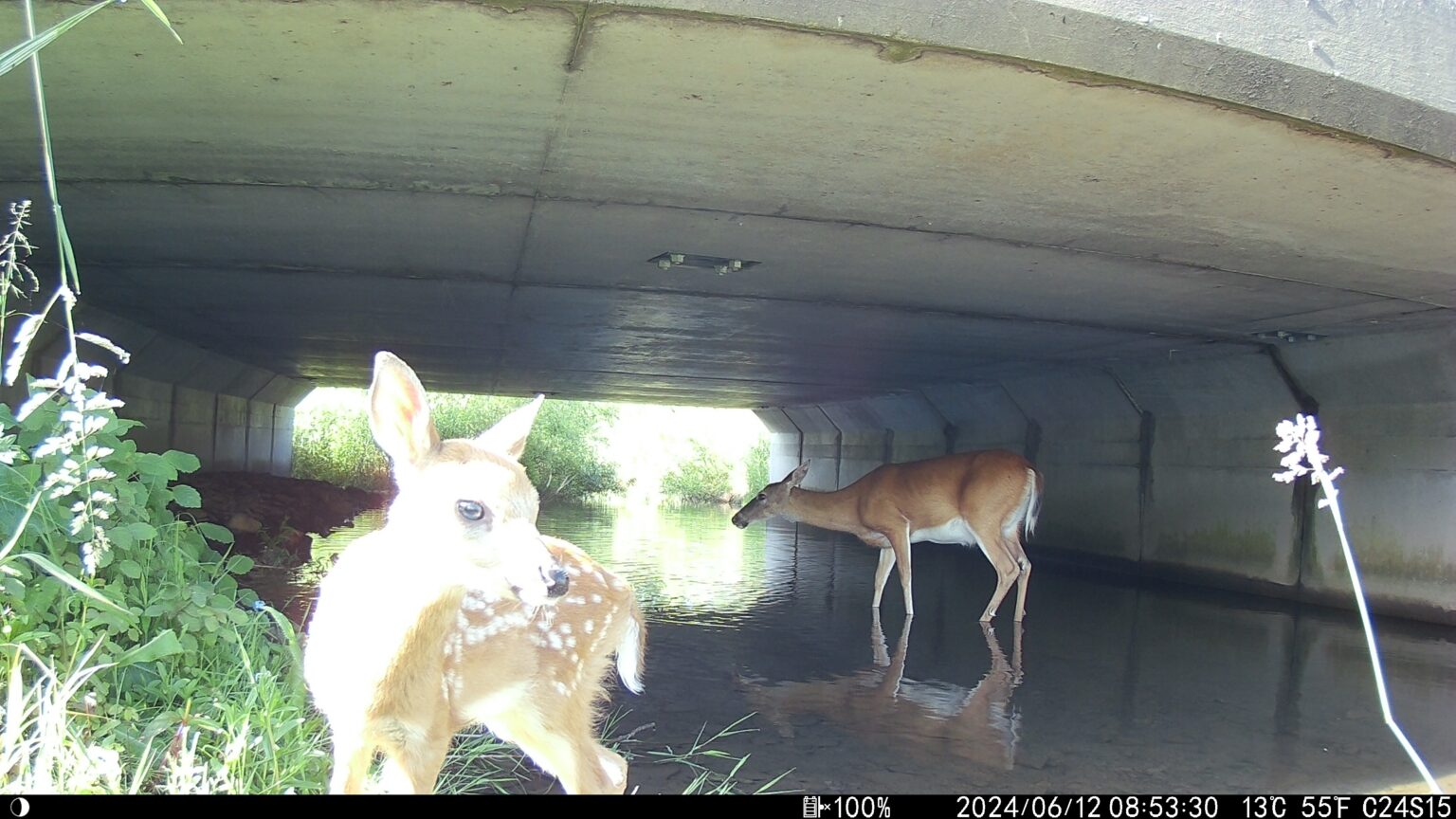
When I became a staff member, I conducted a wildlife occupancy study with Sarah Williams, a quantitative ecologist based in Montana. We installed 45 trail cameras to assess occupancy across the WNY Wildway. We used a randomized grid and placed sampling points on protected areas where we could get permits, like state lands, federal lands and conservation properties, as well as some roadway culverts through our work with the New York Department of Transportation.
Across those 45 random sites, I was basically bushwhacking into the woods, dropping motion-activated, solar-powered cameras, and checking them over the course of a full year just to make sure vegetation wasn’t blocking them. We ended up with 31 protected area sites and 14 roadway sites.
From that, we got a really exciting picture of what’s moving through the landscape. We got about 40 black bear (Ursus americanus) detections across the region, mostly in the southern tier and especially around Allegany State Park. We had 81 fisher detections across 17 sites, which was really exciting because one of the highest detection sites was Lawton Woods, a conserved private forest in southern Erie County. We even had long-tailed weasels (Neogale frenata) and river otter (Lontra canadensis) show up, which just reinforced how much wildlife is using these connected areas.
How are WNY Wildway priorities being translated into on-the-ground action?
Since roads are a major source of habitat fragmentation, we partner with the New York Department of Transportation. Its involvement has created opportunities to address wildlife crossings and reduce vehicle collisions, which are a significant safety issue in the region.
By overlaying the WNY Wildway’s prioritized habitat and corridor maps onto the state road system, we are identifying key culverts and road segments where upgrades could improve wildlife movement and driver safety. One of the things I find really exciting about this work is that it’s not a “break-the-bank” solution. Every wildlife crossing we’ve looked at actually saves more money than it costs to construct, so they’re always a no-brainer.
This collaboration has already led to targeted upgrades of several culverts in western New York, designed to allow wildlife passage through relatively simple modifications.
Article by Kaylyn Zipp