
Share this article
Duck! It’s a drone!
The use of drones in the wildlife field has soared over the last five years, from tracking polar bear activity in the Arctic to fighting rhino poaching in South Africa. One of the most popular uses has been to count populations in hard-to-reach areas. But how can scientists be sure their counts are accurate?
That question gave rise to the Epic Duck Challenge.
“There is no known number of individuals in wild populations,” said Jarrod Hodgson, first author on the paper published in Methods in Ecology and Evolution. So he and his team set out to count a number of individuals they could verify — plastic duck replicas arranged on the beach — and compare counts determined from drone photos to counts by experts on the ground.
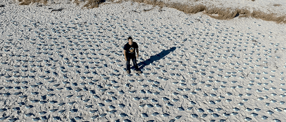
Decoys stand in for actual seabirds in the population counting experiment. ©Jarrod Hodgson
“We could create colonies where we knew the true number of individuals and look at the accuracy of both counting approaches,” said Hodgson, a doctoral student at Australia’s University of Adelaide.
The counts from the drones’ images, they found, were far more accurate than the experts’ ground-based counts.
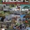
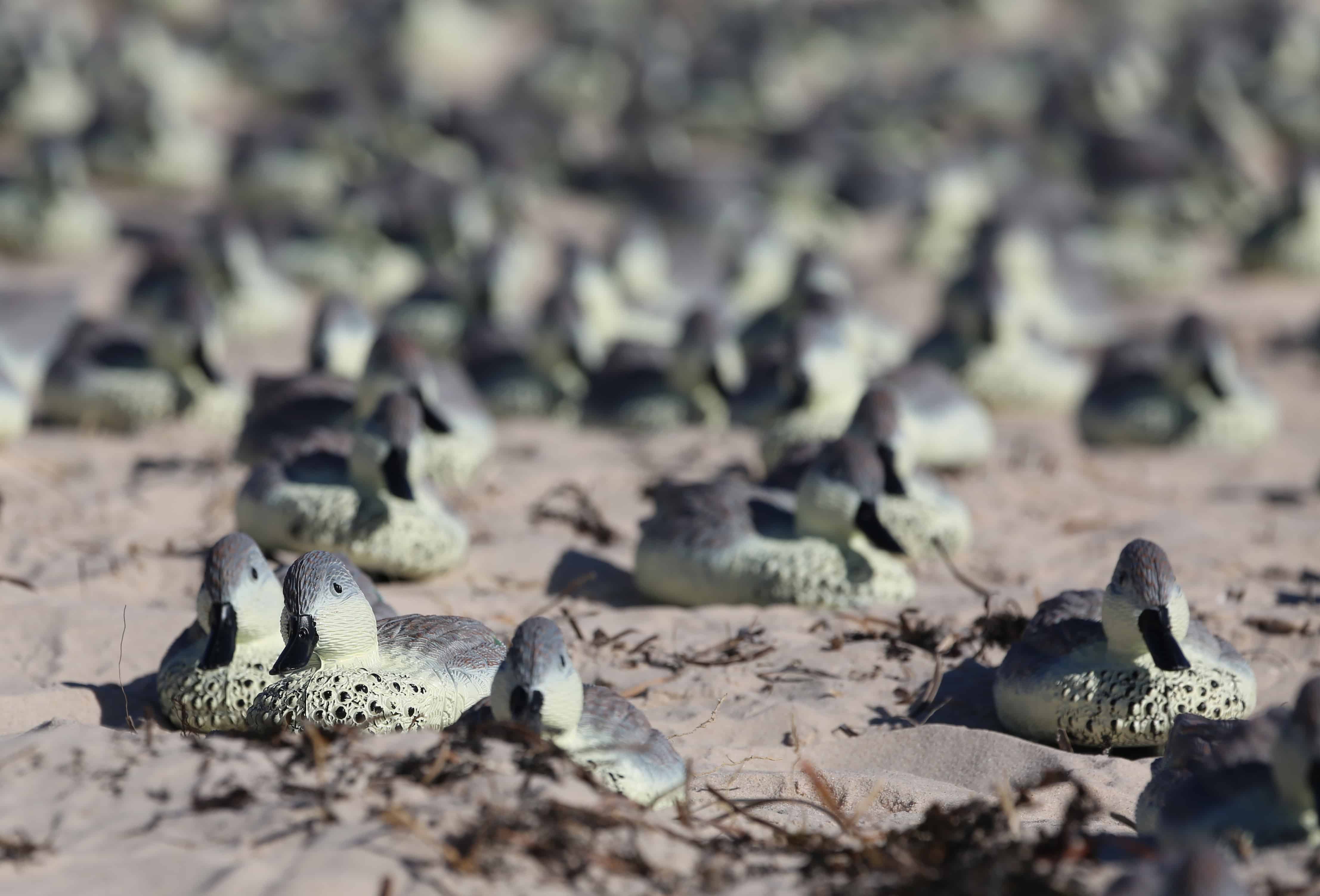
For what they called the Epic Duck Challenge, the team of biologists used the dummies to duplicate not ducks but greater crested terns (Thalasseus bergii) nesting on a beach in South Australia. Following a model that simulated how real terns position themselves on the sand — within pecking distance of one another — they placed the decoys in 10 colonies of 500 to 1,000 animals. Hodgson and his colleagues then compared population numbers obtained from ground counts performed by skilled wildlife spotters to those produced through analyses of photos of the fake ducks taken by drones at various heights.
“People counting the number of birds in aerial images was between 43 and 96 percent more accurate,” Hodgson said, with accuracy improving as the altitude decreased and the quality of the shots increased.
The researchers also trained an open-source algorithm to detect the replicas in drone-generated photographs, which performed just as well as humans but in a fraction of the time. This tool could make population monitoring more efficient and less costly when modified to recognize other species in different environments, Hodgson said.
Fake ducks sit on the beach in South Australia, photographed by a drone above. ©Jarrod Hodgson
“By using drone data that is more accurate and more precise, there is more confidence in population estimates, which means you can detect finer-scale fluctuations in a population,” he said. “This can inform more proactive management.”
Since most previous studies about the effectiveness of drone imagery for population assessments haven’t focused on accuracy since it’s impossible to know the exact size of populations in the wild, Hodgson said, “this study was important to give bounds around how good the drone approach was.”
Hodgson believes the findings can be extended to real birds that are easily seen from overhead, including colonial seabirds like gannets (Morus spp.), penguins and frigatebirds (Fregata spp.) and waterbirds like pelicans (Pelicanus spp.) He and his colleagues are now investigating how successfully drones can be used to count other types of wildlife, from seals on seashores to koalas (Phascolarctos cinereus) and orangutans (Pongo spp.) in trees. They’re also looking into how to mitigate any negative impacts the technology may have on wildlife, so biologists can “get highly accurate data with minimal disturbance,” he said.
“There’s some exciting times ahead for wildlife management,” Hodgson said.

Header Image: A researcher gazes up amidst an artificial colony of greater crested terns. ©Jarrod Hodgson
Related Posts

2024 TWS Elections: Canadian Representative
This year’s nominees for Canadian Representative to TWS Council are Al Arsenault and Dennis Brannen
Gentrification brings more wildlife to urban areas
Some neighborhoods have more access to nature than others, researchers found
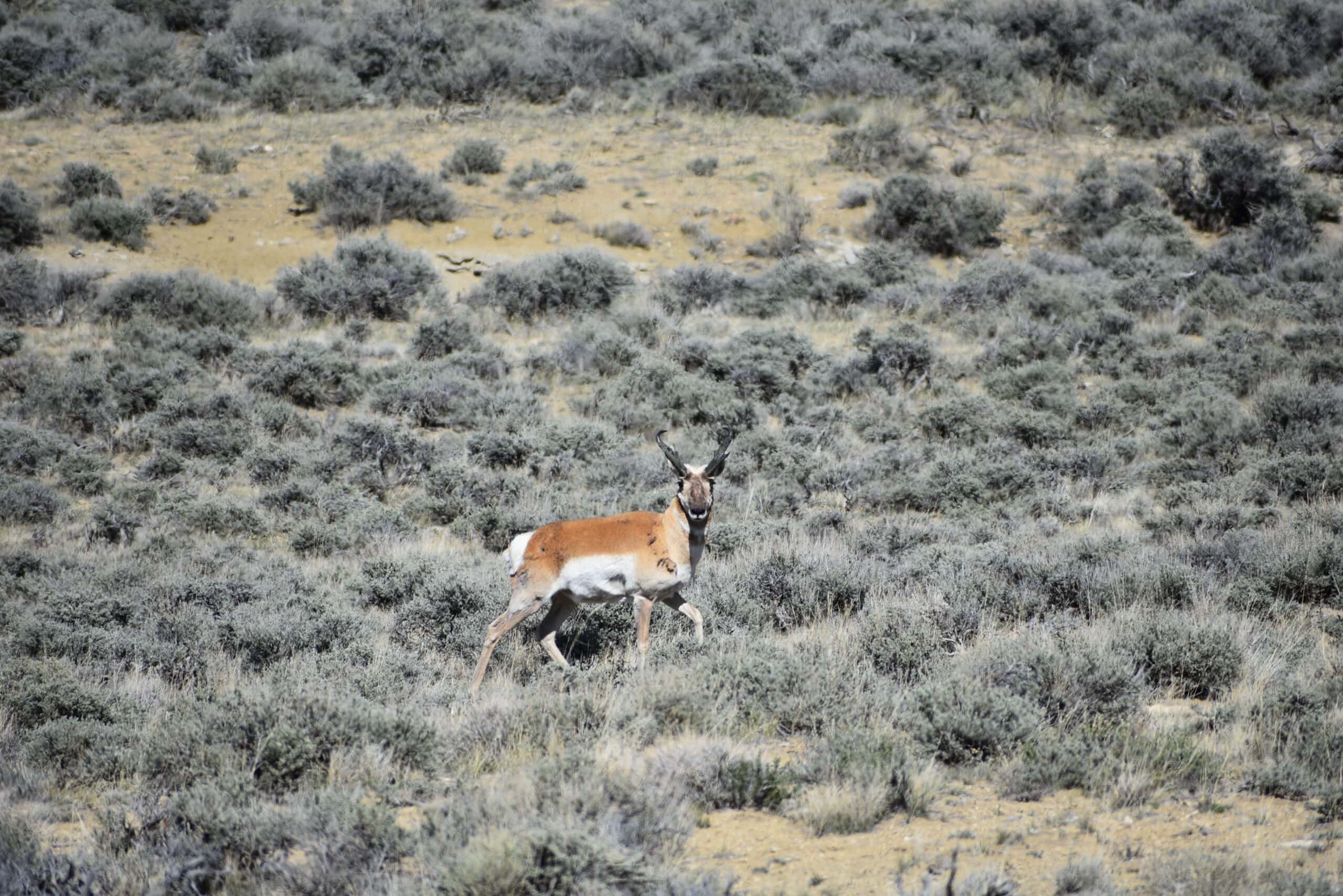
Oil and gas development, tree cover not good for pronghorn productivity
Ungulate productivity decreased with more trees, fossil fuel extraction in Wyoming