


Powerful Tracking Tools to Help Reduce Raptor Conflicts
After the devastating effects of DDT and other organopesticides on birds across the United States, the extraordinary comeback of many birds of prey in recent decades — most notably bald eagles (Haliaeetus leucocephalus), osprey (Pandion haliaetus) and peregrine falcons (Falco peregrinus) — is an indisputable story of conservation success. This major accomplishment represents the hard work and persistence of countless wildlife professionals. Today, in areas of the upper Midwest and along the Atlantic seaboard, bald eagle populations are increasing exponentially and osprey numbers have returned to or even exceeded historic levels in northeast states and within the Chesapeake Bay.
Although highly abundant raptor populations create many positive ecological and social impacts, human-wildlife conflicts also can result from conservation successes such as this one. Over the past decade, U.S. Department of Agriculture’s APHIS Wildlife Services has relocated more than 13,000 raptors while also examining technologies to reduce aircraft strikes — an effort that earned the agency the 2014 Federal Migratory Bird Stewardship Award from the Council for the Conservation of Migratory Birds.
Combining traditional methods with new technologies — along with scientist-public partnerships and research — can guide methods to reduce conflicts while increasing our basic knowledge about raptors.
With Success Comes Challenge
Without a doubt, the most prominent example of conflicts that occur with birds of prey is the one that causes the greatest safety concern. Like many wildlife species, these birds commonly use habitats and areas on or near civilian airports and military airbases as places to loaf, forage and nest. This behavior creates a very serious risk to safe aircraft operations. A recent evaluation of eagle-aircraft collisions with commercial and military aircraft in the U.S. found that reported aircraft collisions with bald eagles increased by 2,200 percent between 1990 and 2014 (Washburn et al. 2015).
Other raptors also interfere with airplanes. Aircraft commonly strike red-tailed hawks (Buteo jamaicensis), American kestrels (Falco sparverius), snowy owls (Bubo scandiacus) and short-eared owls (Asio flammeus) at airports. The aircraft usually — but not always — emerge unscathed. However, most strikes are debilitating or deadly for raptors.
Science-based, publically acceptable mitigation measures, many of which are currently being developed and evaluated such as transmitters, are needed to combine effective management actions with monitoring. These tools will provide a better understanding of human-raptor conflicts and help ensure successful coexistence in the future.
Cutting-Edge Technologies
Over the past 15 years, unprecedented advances have been made in developing biotelemetry tools and methods. Animal-mounted transmitters are now capable of providing location information with GPS accuracy, movement characteristics such as altitude and flight speed for birds, higher volumes of data per unit of time, and the ability to track animals on a global scale.
Researchers can now extract data from transmitters attached to animals, birds and even fish in near-real time from geostationary satellites such as the ARGOS satellite network or via the Groupe Spécial Mobile (GSM) cellular communication towers. In fact, you might think of it as the animals sending you texts. At the same time, smaller and lighter transmitters have allowed researchers to track many more wildlife species that could not accommodate larger devices.
These new technologies come with their own challenges including the need to manage extremely large volumes of reported data and to decipher patterns of spatial analysis and animal movements. Fortunately, our profession’s many excellent biometricians are currently developing and using important statistical tools to tackle the data.
My colleagues and I are using these satellite and GSM transmitters to study the breeding, migration, and wintering ecology of several raptors, including bald eagles, osprey, red-tailed hawks, and snowy owls. These new tools are essential for our work because traditional tools such as banding and VHF radio telemetry are either incapable of answering the research questions or the financial and logistical constraints are simply too great.
Although these newer transmitters are very useful, the advantages of going “old school,” or using more traditional tools, should not be overlooked. Studies using banding and auxiliary marking/resight methods laid the foundation of our ecological knowledge of many wildlife species. In fact, depending on a study’s specific objectives, the traditional methods might be the more practical and efficient choice. Essentially, traditional methods allow us to learn a little information about a large number of birds, whereas the newer techniques enable us to collect a large amount of detailed data but usually only for a small number of subjects due to costs.
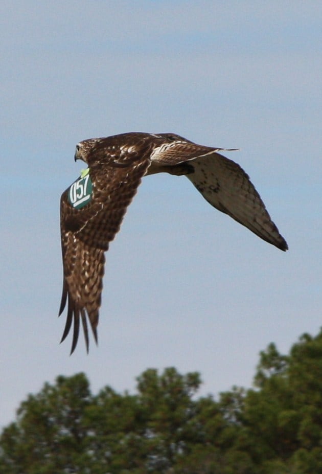
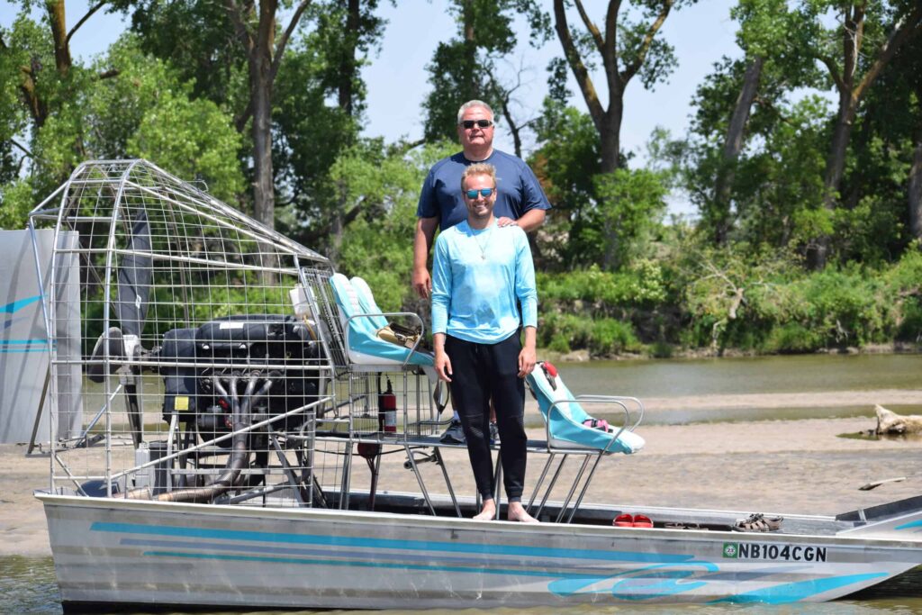
Image Credit: Linda Reynolds
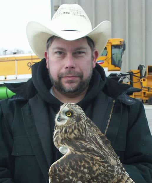
In research that my colleagues and I are currently conducting on short-eared owls that inhabit airports in the upper Midwest during winter months, we are using both traditional and new technology to study the birds. Due to their flight patterns and other factors, the owls frequently collide with aircraft along active runways. Although not federally listed, shorteared owls have threatened or endangered status in at least six states and are therefore of interest to many state wildlife agencies.
We chose to use live-capture, banding and translocation away from airports because GPS-accurate satellite trackers are not currently available for this species. Banding birds with a feathered tarsus isn’t ideal for identification at a distance; therefore, we are using more traditional VHF radio-telemetry in another study for tracking the owls during their wintering period. Although traditional VHF radio-telemetry can be labor-intensive, it is more useful for studies in small geographic areas or during periods of time when birds are not making long-distance movements.
Reducing Raptor-Human Conflicts
Until more data from such studies designed to improve coexistence of the birds on or near airports is analyzed, airport wildlife biologists use an integrated wildlife damage management approach when attempting to reduce the risk of wildlife-aircraft collisions. Federal and state legislation and regulations related to wildlife conservation and management outline the constraints and conditions that these efforts must follow to reduce or eliminate specific conflicts between humans and raptors. For example, bald eagles and golden eagles (Aquila chrysaetos) are protected by the Bald and Golden Eagle Protection Act, in addition to the Migratory Bird Treaty Act.
Several different methods are available to decrease raptor presence on airfields; however, airport biologists frequently live-capture and translocate birds away from the airport environment. To ensure this technique is used in the most appropriate and effective manner, Wildlife Services’ operational and research programs have been conducting a series of research projects at North American airports on several species including red-tailed hawks.
In Illinois, a series of studies using traditional and cutting-edge methods demonstrates how we are examining the risk this species poses to aircraft and evaluating various management options to reduce this risk. To evaluate potentially important factors in a raptor relocation program, we banded and placed patagial wing tags on more than 900 red-tailed hawks captured on Chicago’s O’Hare International Airport. We chose to use this method because the cost of transmitters and data acquisition for a study of this size would have been prohibitive.
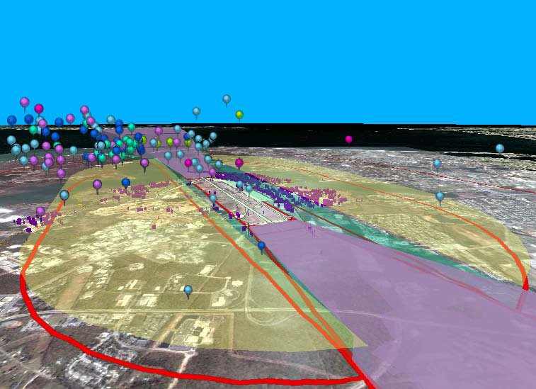
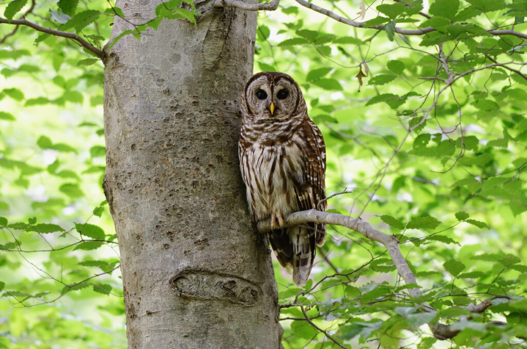
Image Credit: Credit: Brian Washburn
Public reports have provided important observations of these marked birds, which were translocated and released. We also have conducted intensive monitoring and recapture efforts on the airport itself. So far, we have identified several factors including the age of a bird and the time of year that can strongly influence whether a red-tailed hawk returns to the airport from which it was removed.
In an associated project, satellite telemetry is helping determine the local and migration movements of a smaller group of red-tailed hawks associated with the airport as well as to quantify the actual risk they pose when they are on the airport or using critical airspace. A third study used GSM transmitters to track movements and habitat use of red-tailed hawks of various age classes following their translocation away from the same airport. The transmitters in these two studies send electronic data on the birds’ locations, movements, flight characteristics and proximity to airports. Collectively, the findings from all three studies are being used by airport wildlife management programs to reduce the frequency and severity of raptor-aircraft collisions.
In Minnesota, my colleagues and I are finishing a study that used satellite telemetry to examine the post-translocation movements of immature bald eagles and to assess the efficacy of this management action in reducing eagle-aircraft collisions. We moved live-captured, immature bald eagles fitted with satellite transmitters to release locations approximately 250 miles north or west of the airport they were frequenting. The findings, based on more than five years of data, suggest that translocating young eagles from active airport environments where they pose a threat to safe aircraft operations is a viable management option, with a westward release more favorable than a northern one.
Understanding Raptor Ecology
Although much of our research program is focused on solving problems, the information collected can provide important contributions to our understanding of raptor ecology. For example, a study funded by the Department of Defense sought to evaluate the risk that ospreys breeding in the lower Chesapeake Bay pose to military flight operations. With Wildlife Services operations biologists, we tagged adult ospreys with satellite telemetry units near Langley Air Force Base located on the Chesapeake Bay near Hampton, Virginia.
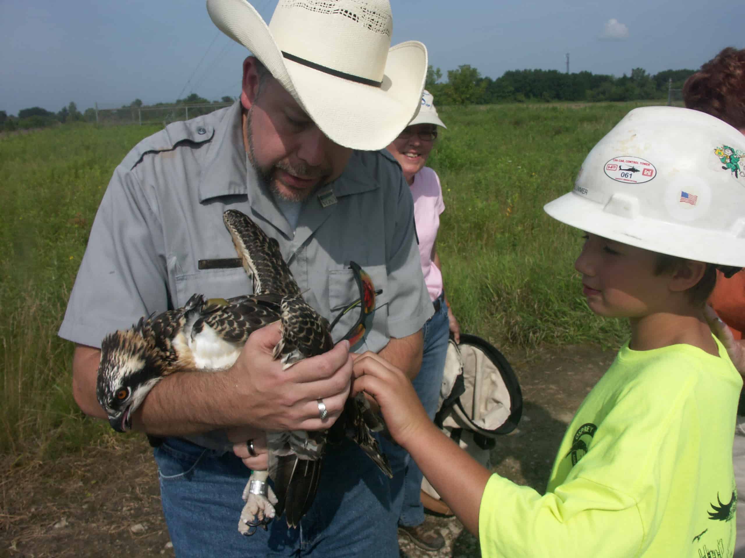
Image Credit: Alexa Martinez
When these birds migrated to their South American wintering grounds, we obtained detailed information on their movements during the nonbreeding period. Combining our work with that of several world-renowned osprey researchers, we were able to gain a new understanding of the wintering habits of ospreys (Washburn et al. 2014). The birds became very sedentary and demonstrated a pattern of limited daily movements and high fidelity to a few select locations, presumably roosts, on their winter grounds.
The Power of Partnerships
While it may seem that researchers with a federal wildlife agency have access to all the resources needed to conduct an extensive research program, this notion is far from reality. Now more than ever, partnerships, interagency cooperation and community involvement often from citizen scientists are essential for the success of wildlife research and management programs. Wildlife professionals — in state and federal agencies, non-governmental organizations, academia and the private sector — all face shrinking budgets, changing priorities, fewer staff and limited logistical resources. In addition to the many skills that we need today, building partnerships and leveraging resources are some of the most important.
In an ongoing research project on the ecology of ospreys in the lower Great Lakes states, Wildlife Services is collaborating on an environmental education program for the public. The effort combines a consortium of federal, state, academic, citizen, and corporate participants including the U.S. Fish and Wildlife Service, the Michigan and Illinois Departments of Natural Resources, the University of Illinois-Springfield, the Detroit Zoo, the Osprey Watch of Southeast Michigan, the American Tower Corporation, and DTE Energy.
Each project partner brings important resources and knowledge to help make the project a success. For example, avian veterinarians from the Detroit Zoo provide health checks for the birds and conduct gender determination through DNA testing, and the private industry partners provide funding for telemetry equipment and access to osprey nests on cellular towers. Migration routes and other information about study birds are posted on a public website — michiganosprey.org — that provides many personal and formal opportunities for the information to be used for environmental education.
![]() Although all wildlife is held in high regard by the public, raptors are accorded special value and are of particular interest to many people including wildlife professionals. The recent popularity of eagle and osprey nest cams — accessible via the Internet — demonstrates how this unique interest is being expressed through social media. Such media outlets also provide an excellent opportunity for public education on raptor ecology and conservation, especially information gained from advanced tools that track migration routes and are fun for children and adults to view (Cushing and Washburn 2014).
Although all wildlife is held in high regard by the public, raptors are accorded special value and are of particular interest to many people including wildlife professionals. The recent popularity of eagle and osprey nest cams — accessible via the Internet — demonstrates how this unique interest is being expressed through social media. Such media outlets also provide an excellent opportunity for public education on raptor ecology and conservation, especially information gained from advanced tools that track migration routes and are fun for children and adults to view (Cushing and Washburn 2014).
When situations allow, inviting members of the public and mass media to attend raptor banding and tagging events can be particularly beneficial. The unique and very personal experience many nature enthusiasts gain through such activities can not only increase project support and encourage citizen scientists to participate, but also provides an excellent opportunity to increase environmental stewardship and wildlife conservation.
Brian E. Washburn, PhD, is a research wildlife biologist with the USDA APHIS Wildlife Services at the National Wildlife Research Center in Sandusky, Ohio.
Article by The Wildlife Society