
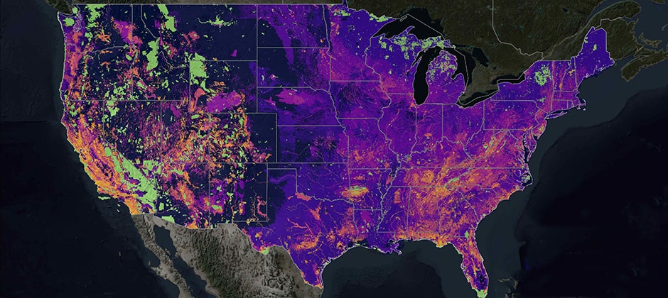
Researchers have created a set of maps to document where biodiversity in the United States is most at risk. The effort is part of a partnership between the nonprofit conservation research organization NatureServe, the geographic mapping platform Esri and The Nature Conservancy. The maps highlight where plants and animals are most at risk of extinction.
“There are hundreds of species known to be globally critically imperiled or imperiled in this country that have no protection under federal law and often no protection under state law,” Healy Hamilton, chief scientist at NatureServe, told the New York Times.
Read the study in Ecological Applications here, and find the maps here.
Article by The Wildlife Society