From the spring issue of The Wildlife Professional.
New USFS technical guide offers strategies and tips
For agencies and organizations to effectively manage wildlife, knowledge about the status and trend of wildlife habitat is critical. Traditional wildlife monitoring, however, has focused on populations rather than habitat, because ultimately population status drives long-term species viability. Still, habitat loss has contributed to the decline of nearly all at-risk species (Swift and Hannon 2010) and, as a result, monitoring the amount and quality of habitat can guide recovery efforts for wildlife species with declining trends such as greater sage-grouse (Centrocercus urophasianus) or the northern long-eared bat (Myotis septentrionalis).
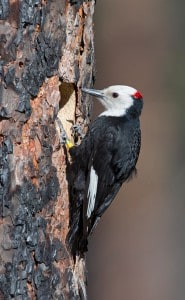
Image Credit: Tom Kogut Photography
To help managers dial in on habitats, the U.S. Forest Service recently released a technical guide for monitoring wildlife habitat (Rowland and Vojta 2013) — one in a series of USFS technical guides and perhaps the first compendium solely dedicated to monitoring wildlife habitat. While land managers and conservation organizations have abundant information on monitoring populations (Manley et al. 2006, Vesely et al. 2006, McComb et al. 2010), the technical guide complements these resources by offering similar guidance on habitat monitoring.
The guide was written by a technical team of 24 authors including wildlife, vegetation and forest ecologists; silviculturists; remote sensing specialists and biometricians who represented USFS research and management, universities and private consultants. The team compiled the best available science, using published literature and their own expertise, to identify principles, protocols and analytical approaches for monitoring wildlife habitat. Although written primarily for USFS professionals, the guide can also benefit other agencies and organizations seeking standardized approaches to monitor wildlife habitat as well as managers and biologists charged with wildlife conservation and land-use planning.
Concepts of Habitat Monitoring
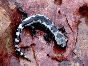
Image Credit: Lloyd Gamble
The technical guide espouses several fundamental premises of wildlife ecology. The first is that habitat is unique for each species. We must fully understand a species’ life history to identify its key habitat requirements (Hall et al. 1997) and associated attributes — defined as “any living or nonliving feature of the environment that provides resources necessary for a species in a particular setting.” Another premise is that habitat is not just vegetation but can also encompass physical features like talus slopes or anthropogenic features like roads. A third premise is that, for most species, habitat is multi-scalar and, as a result, monitoring programs must identify the scales at which a species operates and the appropriate attributes for each. For example, wildlife managers studying wolverines (Gulo gulo) might monitor the extent of recently logged areas or terrain ruggedness at landscape scales, while studying percent area affected by avalanches — a proxy for the availability of carrion — at fine scales (Krebs et al. 2007).
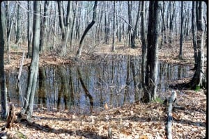
A vernal pool in Massachusetts serves as breeding habitat for the marbled salamander (above, left) — a species ranked as imperiled in that state. Citizen scientists are mapping these important features as part of the Vermont Vernal Pool Mapping Project — an ambitious effort to raise awareness about the value of these pools.
Image Credit: Vernal Pool Association
Landscape analysis is another key component of habitat monitoring, because landscape pattern metrics such as edge density, patch size and patch isolation can strongly influence habitat quality at broad or intermediate scales. For example, a landscape composed of closely spaced patches of mature forest can serve as habitat for salamanders with limited dispersal ability. If patches become more isolated over time, however, habitat quality is diminished even if fine-scale forest structure within the patches is still optimal.
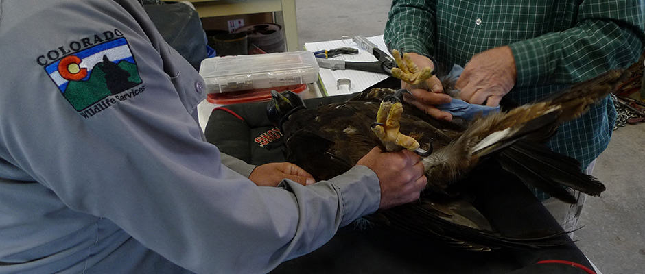
Although not traditionally regarded as a habitat attribute, human disturbances such as energy development or recreation can impact populations and use of otherwise suitable habitat. Effects of wind turbines on golden eagle (Aquila chrysaetos) fatalities and habitat loss are just one example of this (Drewitt and Langston 2006, Smallwood and Thelander 2008). As a result, well-designed protocols to measure the extent, duration and magnitude of these disturbance factors can be integral to a habitat monitoring program.
The guide emphasizes the importance of standardized monitoring protocols as monitoring relies on repeated measures to evaluate change over time. Given the typically high costs of collecting field data, the technical guide encourages using existing data and protocols as much as possible, especially from ongoing, standardized efforts — like the USFS Forest Inventory and Analysis program — updated on a regular basis. Other data sources include spatial and tabular information about vegetation composition and treatments collected by national forests and grasslands and stored in standardized databases, or high-resolution photographs available across the continental U.S. at no cost through the National Agriculture Imagery Program.
Monitoring Tips for Wildlife Managers
Managers should follow a sequence of steps to develop a defensible, affordable, and feasible habitat monitoring program such as defining goals, selecting emphasis species, developing conceptual models, and identifying key attributes to monitor. Data management is also important including evaluating the use of existing data, designing new data collection, making stored data easily accessible and incorporating monitoring results into adaptive management.
Consider the American marten (Martes americana): In order to develop a monitoring program, land managers would first develop a conceptual model that graphically displays habitat stressors and their effects. For example, activities or disturbances such as wildfires or forest type conversions that create large, open areas serve as primary landscape scale stressors for the species. In contrast, site-scale stressors may include activities that reduce the abundance of snags and large-diameter down wood that martens use for denning and resting sites.
These conceptual models form the basis for identifying habitat attributes to monitor. In the guide, authors demonstrate how to boil down a complex conceptual model into a practical set of measureable habitat attributes. For martens, the authors suggested three landscape attributes: specific combinations of vegetation type and structural stage, habitat connectivity, and large patches of contiguous habitat. They also selected one disturbance agent: road density. Site-scale monitoring attributes included the density of snags and down wood pieces in particular size classes. For snags, a threshold of 1.5 snags per acre for large snags (those greater than 10 inches in diameter at breast height [DBH]) would trigger management action; similarly, a density of less than 1 log per acre for down wood pieces greater than 12 inches in DBH would result in re-evaluation of current management actions.
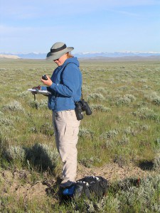
A biological technician samples sagebrush in western Wyoming — an effort that reveals important characteristics such as canopy cover, shrub height and diversity and abundance of forbs for sage dependent wildlife including the greater sage-grouse and pronghorn.
Image Credit: Mary M. Rowland
Forest Service biologists recognize that consistency in monitoring protocols for American marten habitat, as described in the guide, will lead to more robust data with broad application across multiple regions, national forests, and districts. Goals for monitoring this widespread habitat specialist in the national forests of the Blue Mountains in Oregon and Washington include habitat modeling of primary versus secondary habitat combined with field surveys to verify the presence of martens. “This effort will be most defensible if all administrative units follow the same monitoring protocols including how data are managed,” says Mark Penninger, wildlife program manager for the Wallowa-Whitman National Forest. “The Technical Guide provides much of this consistency for the planning and organization of monitoring efforts.”
The guide also stresses the need to couple habitat with population monitoring (see text box). In fact, in one of the most comprehensive wildlife monitoring strategies developed yet, the Rocky Mountain Research Station and Pacific Northwest Region of the USFS are leading an ambitious effort to monitor the white-headed woodpecker (Picoides albolarvatus), a regional endemic of the western U.S. and Canada (Mellen-McLean et al. 2013). This species relies on a mosaic of open and moderate-canopied ponderosa pine (Pinus ponderosa) forests with mature, cone-bearing trees, a vegetation type that has declined precipitously in the interior Pacific Northwest (Hollenbeck et al. 2011). Other partners include the Oregon Bureau of Land Management, the Payette National Forest in Idaho, and three Collaborative Forest Landscape Restoration programs. As part of the strategy, wildlife managers not only monitor woodpecker populations, they also evaluate habitat suitability for nesting woodpeckers in burned and unburned forests and determine historical and future nesting habitats under different climate and management scenarios. “Having a good strategy and protocols already set up has really helped,” says USFS regional wildlife ecologist Kim Mellen-McLean, who is part of the woodpecker monitoring team and has used the technical guide for the project.
Future Directions in Habitat Monitoring
As resources to manage and monitor wildlife habitat become ever scarcer, we need fresh approaches for monitoring. One possibility is citizen science — the use of volunteers to record data while afield. Although citizen scientists have contributed valuable population data by recording the whereabouts and numbers of popular taxa such as birds and butterflies, similar engagement in reporting wildlife habitat features is uncommon. Given simple but standardized protocols and clear instructions for use with tablets and smartphones, myriad volunteers could upload habitat data for storage in cloud-based programs. Undergraduate students in environmental programs are especially suited for these activities and could gain valuable field experience.
Although field-collected data are requisite for most habitat monitoring, impressive advances in remote sensing will lead to increased reliance on these methods. Costs of sending crews to the field continue to rise, whereas resources and tools like high-resolution aerial photography, lidar, drones and national spatial data sets such as the National Land Cover Database are increasingly available and often free. In fact, in a recent innovative study in Spain, biologists used Google Street View to accurately identify nesting cliffs for vultures (The Wildlife Professional Spring 2014).
Sweeping impacts caused by factors like climate change, land use and invasive species will also influence future habitat monitoring. Traditional characterizations of suitable habitat could lead us astray, as species adapt to conditions previously considered unsuitable. For example, the rare Swainson’s warbler (Limnothlypis swainsonii) has recently colonized the ubiquitous pine plantations of the southeastern U.S. — a surprising but perhaps ultimately beneficial move for this species once considered a habitat specialist of bottomland hardwoods and other swampy environs (Graves 2014). Likewise, the appearance of novel ecosystems — new combinations of species that arise from human action, introduced species or environmental change — will require creative and open thinking about what defines habitat for some species (Hobbs et al. 2006).
As the world becomes more dominated by the actions of humans, the complexity of threats to wildlife habitat will, more than ever, require strategic wildlife habitat monitoring. By using standardized protocols as described in the technical guide, mixed with creativity and foresight, biologists and land managers can ensure that habitats are conserved for large suites of species well into the Anthropocene.
Habitat versus Population Monitoring
 The USFS Technical Guide’s emphasis on habitat monitoring does not preclude the need for population monitoring, because specific habitat components are not always strongly coupled with population dynamics (Cushman et al. 2008). Some populations of spiny lizards, for example, may be declining due to temperature warming during the breeding season (Sinervo et al. 2010), rather than habitat limitations. Further, the U.S. Fish and Wildlife Service often requires population monitoring in recovery plans for threatened and endangered species.
Habitat monitoring, however, is sometimes more logistically feasible than population monitoring. This is especially true for species that are at low risk but difficult to detect — like the northern pygmy-owl (Glaucidium gnoma) — owing to the extensive effort required to sample populations versus habitats. Even so, biologists should periodically compare habitat with population monitoring data to verify the presumed relationships between the two. Although habitat is essential for population persistence, the maintenance or restoration of habitat does not guarantee population persistence or recovery (Mulder et al. 1999).
Last, habitat monitoring may be critical when the ecological trajectory of habitat is unclear, for instance when evaluating habitat responses to novel management activities or anthropogenic disturbances. Global climate change will also demand critical rethinking about what we have previously defined as habitat for species and whether “habitat” as we know it will persist into the future.
Author Bios

Image Credit: Courtesy of Mary M. Rowland
Mary M. Rowland is a research wildlife biologist for the Pacific Northwest Research Station of the U.S. Forest Service. She currently serves as treasurer of the Biological Diversity Working Group of The Wildlife Society.
Lowell H. Suring, CWB, is a principal wildlife ecologist with Northern Ecologic, LLC. in Wisconsin and a member of the TWS 2014- 2015 Honorary Membership and Special Recognition Awards Selection Committee.
Christina D. Vojta, PhD is associate director of the Landscape Conservation Initiative at Northern Arizona University in Flagstaff, AZ, and adjunct faculty in NAU’s School of Earth Science and Environmental Sustainability.
