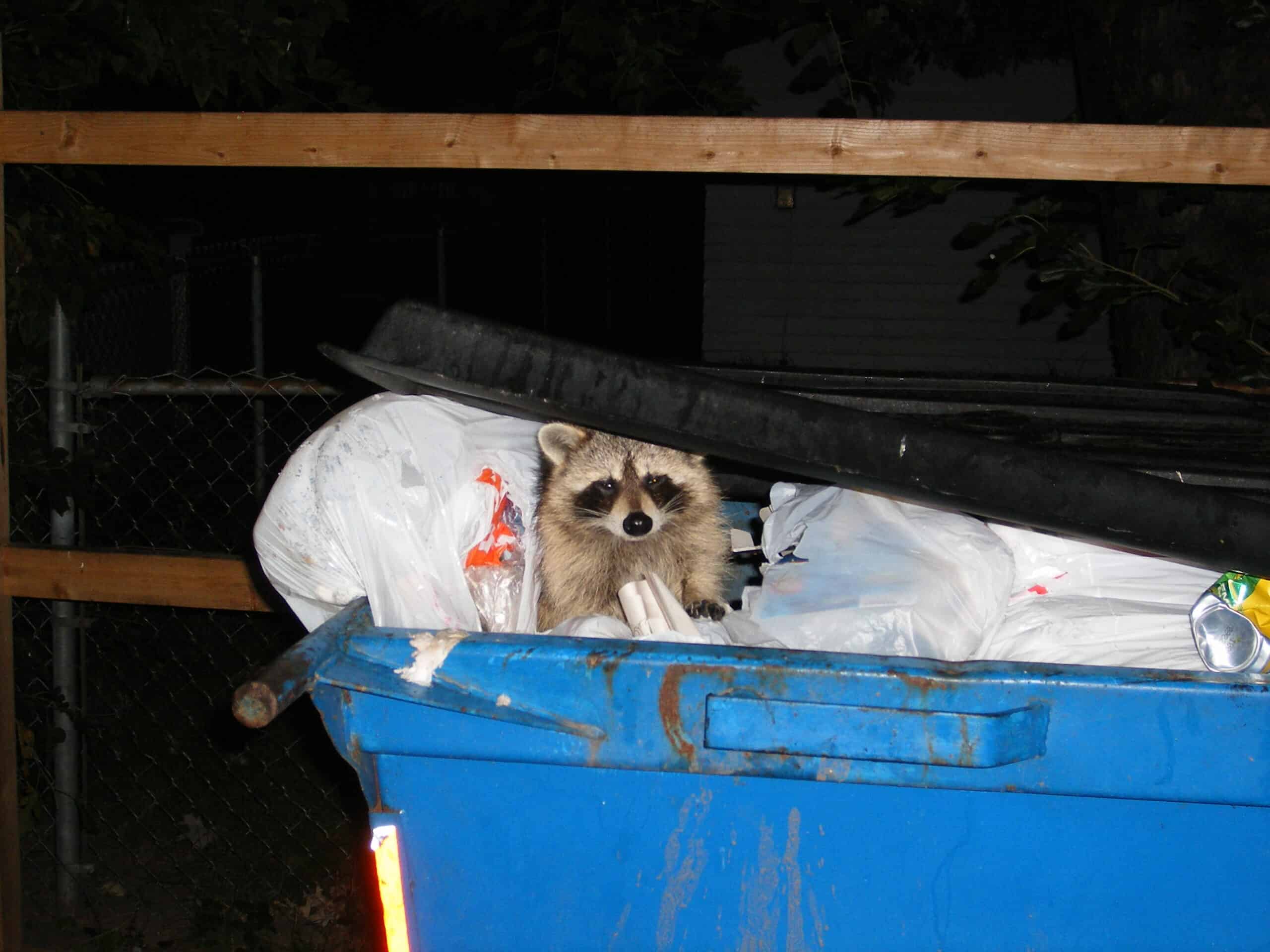
Shortened snouts, white patches, and floppy ears aren’t just cute quirks — they’re hallmark traits of “domestication syndrome,” the suite of changes that emerges when a subpopulation begins adapting to a new human-shaped niche. Urban environments may provide space for the experiment, recreating the ancient commensal niche that once drew wolves into the glow of human campsites, by giving raccoons the chance to scavenge our urban leftovers.
To test whether urban raccoons (Procyon lotor) exhibit one hallmark of domestication syndrome, shortened snouts, researchers recently analyzed 19,495 raccoon images submitted to iNaturalist from across the contiguous United States. Researchers calculated a snout-to-skull ratio for each raccoon by measuring snout length from the nose tip to the tear duct and skull length from the nose to the midpoint between the ear’s attachments.
The study found that urbanization exerts a measurable, directional, selective pressure, with urban raccoons consistently showing a 3.56% reduction in snout length compared to rural raccoons. Shorter snouts in urban areas persisted across climate zones even after accounting for naturally shorter snouts in warmer regions.
Raccoons may not make the perfect Christmas pet yet, but researchers have a rare gift—the chance to watch the first steps of domestication play out in real time, right outside our doors.
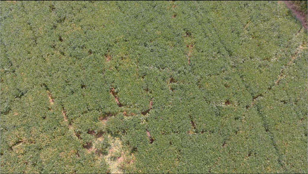
In some ways, the spread of invasive wild pigs across the U.S. resembles the path of a hurricane. They are nearly impossible to stop, destroying entire crops and ruining human property. The widespread destruction they engineer in native ecosystems may be even longer lasting than a tropical storm.
What’s more, new research shows that Missouri’s strategy of responding to the pig problem like it’s a hurricane with a collaborative task force is part of the reason for the state’s unique success in pig control.
“The incident command systems are really born out of disaster response systems,” said Megan Cross, a social scientist with the U.S. Department of Agriculture’s Wildlife Services, describing the holistic program created for wild pig control.
In a study published recently in the Wildlife Society Bulletin, Cross and her co-author, Keith Carlisle, also with Wildlife Services, examined the reasons for Missouri’s unique success in controlling wild pigs (Sus scrofa).
Wild pigs can devastate human infrastructure, agriculture and the native ecosystem when they take hold. They are found in more than 30 states and populations are well-established in many, including some that border Missouri. But a bevy of new rules and measures have beaten back the rising tide of wild pig invasion in Missouri, turning the Show Me State into more of a We’ll Show You How State.
A change in pig perspective
As Cross and Carlisle began to look into the reason for the state’s success, they found that Missouri was unprepared when wild pigs started to appear there in the 1990s. Interviews with wildlife managers who were around in the early years revealed that Missouri approached the problem in much the same way as other states now overflowing with swine. They used limited state funds to trap and remove some animals while encouraging hunters and trappers to pick up the slack.
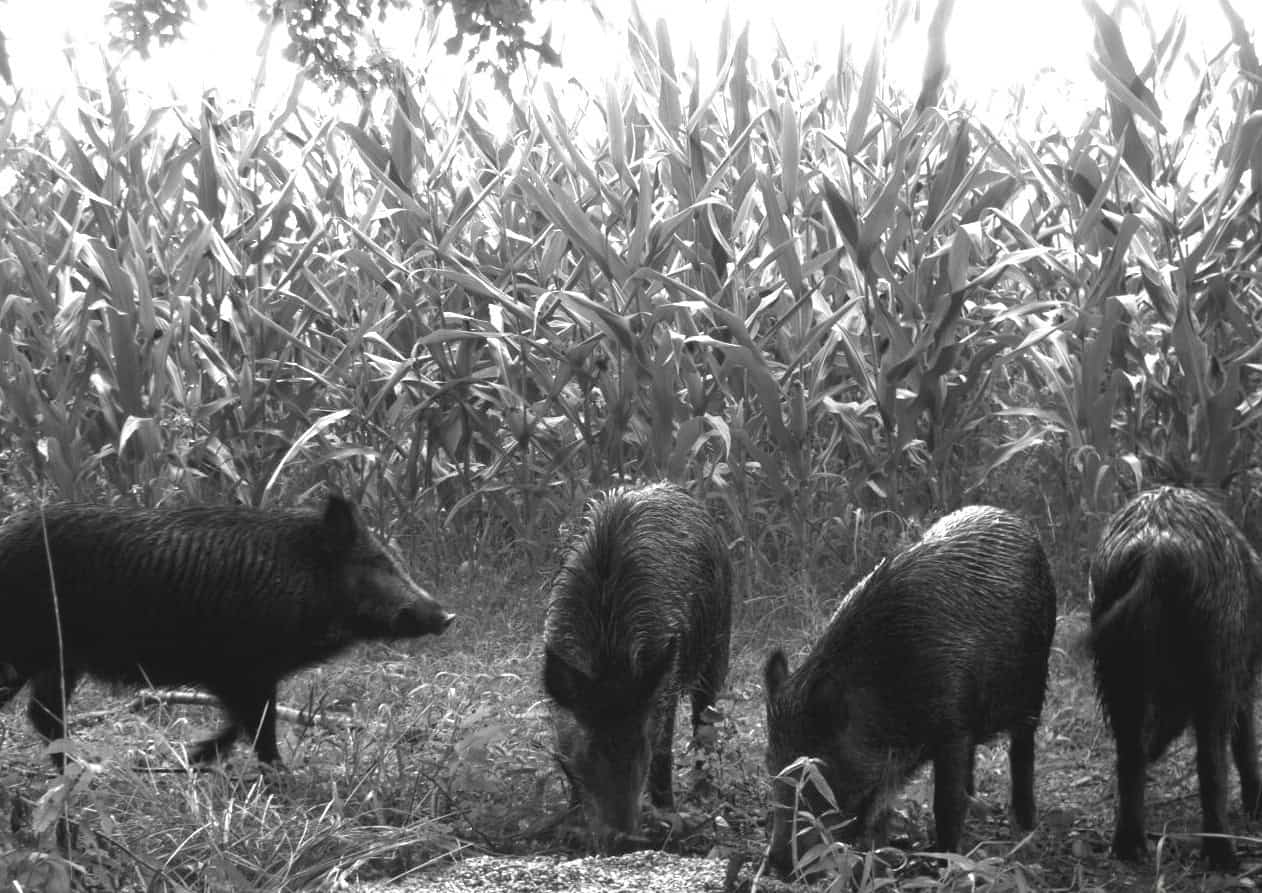
Pigs are invasive ecological engineers as they create wallows, changing the suitability for native species as well as agriculture. Credit: NASA
But this method has proven not to work. Other research has shown that states that open up hunting laws to allow for the public harvest of wild pigs may inadvertently create an economic incentive to promote the spread of wild pigs, especially when rules prohibiting the transportation of wild pigs are lax or nonexistent. Outfitters and guides can earn a lot from these kinds of hunts. In some cases, the potential for big money leads to political lobbies that seek to weaken anti-swine regulations.
In Missouri, it took more than a decade for the Missouri Department of Conservation (MDC) to change their approach. Cross and Carlisle conducted surveys with 37 people from 15 agencies and organizations in Missouri to determine what changed and how they achieved success.
The MDC began to realize that its current plan was not working by 2007, when the agency partnered with private landowners, the federal government and nonprofit organizations and began to get a handle on the growing problem. As part of Missouri’s strategy, the state banned the transport of pigs, which started a process to help control their spread.
By 2015, the Feral Hog Elimination Partnership had begun to form between the various stakeholders.
These partnerships were incredibly important, Cross said, as the MDC wouldn’t have been able to accomplish what they have without broad buy-in. It involved entities like the Missouri Farm Bureau, the U.S. Fish and Wildlife Service, the U.S. Army Corps of Engineers, Wildlife Services, the Nature Conservancy, private landowners, the U.S. Forest Service and the National Park Service.
By the end of 2019, most partners had banned wild pig hunting on their lands, but perhaps the most consequential move came when the U.S. Forest Service moved to stop the practice in the Mark Twain National Forest—a place where pig-hunting enthusiasts had already begun to transfer the animals for the sake of sport.
Cross said this move was critical due to the sheer size of Mark Twain, which is about 1.5 million acres of land across 29 counties. But the move was controversial, and the partnership needed to produce results that proved that the move, unpopular among some hunters and trappers, would actually work. The MDC began to implement pig removal via staff and partners in Mark Twain and other areas.
Wild pig strike team
The partnership created an incident command system (ICS)—a management team that coordinated pig removal efforts across lands managed or owned by the various state, federal, private and nonprofit stakeholders involved.
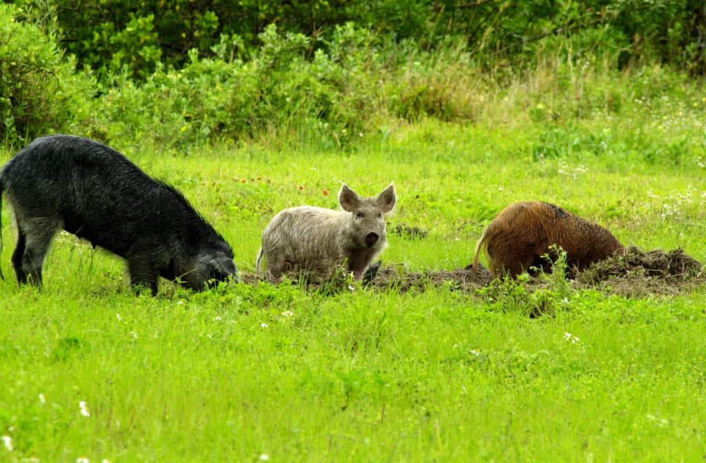
Wild pigs move through a soy crop. Credit: USDA/APHIS/Wildlife Services
The group divided the whole state into territories that “blurred the lines” between the stakeholders. Responding to hotline calls or other reports of pigs or pig damage, strike teams made up of MDC and staff from Wildlife Services could move freely onto lands managed by organizations participating in the Partnership. They conducted removal efforts and responded to reports of damage from private land owners.
“If you’re in Missouri and you have pigs on your property, the ICS is going to handle it,” Cross said.
The team created systematic baiting in the Mark Twain National Forest and other areas, set up traps on a grid system, and shared resources between partners in the ICS. They also shared information on best practices and strategies and the movement of pigs across the land. Finally, the ICS developed agreements with stakeholders in some neighboring states, allowing the strike teams to cross borders while tracking pigs. This helps to reduce the likelihood of the animals crossing the border and establishing populations in Missouri.
The ICS has been successful in reducing wild pig numbers in Mark Twain National Forest—perhaps their main stronghold 20 years ago—and in other parts of the state. “Full-time specialists were much more effective than people who were only trapping pigs part-time,” Cross said.
In effect, this system worked similarly to those set up to manage and respond to natural disasters like hurricanes or tornadoes. But while those systems are usually formed for a short period of time to respond to the disaster, Missouri’s swine control ICS has been around for years now—the longest such ICS that Cross and Carlisle could identify in scientific literature.
Aside from directly controlling wild pigs on the landscape, the ICS also coordinated with law enforcement officers in Missouri, which helps in the enforcement of laws against hunting and transporting the animals. The inability to hunt pigs on public land had already reduced the incentive for people to pull up with a trailer full of pigs and release them on public lands, Cross said.
“Missouri was a standout in the effort,” Cross said. “These laws and hunting closures are one piece of the puzzle. Their operations on the ground are also quite sophisticated.”
Click here to read The Wildlife Society’s issue statement on feral swine in North America.
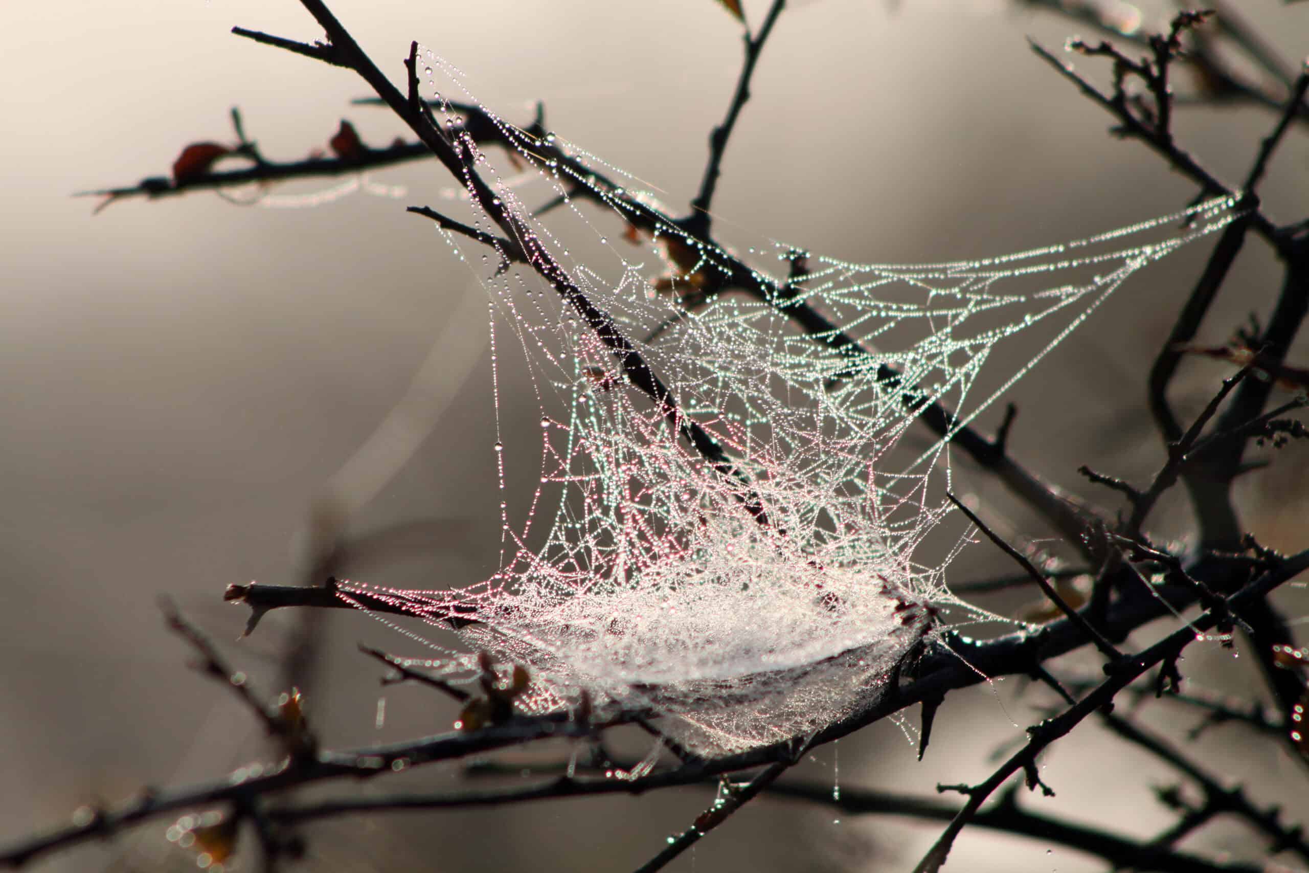
You might brush aside the cobwebs in your door frame without thinking twice, but researchers have found that those fragile threads capture more than unlucky insects.
New research compared spiderwebs with active air samplers, wind-powered samplers, bare filter media, soil and swabbed vegetation surfaces as potential passive samplers of environmental DNA (eDNA) sources near the Perth Zoo, a rich controlled source of biodiverse species, as well as the Karakamia Wildlife Sanctuary in Western Australia. The researchers aimed to compare how different eDNA sampling methods perform, identify which substrates capture the most representative vertebrate biodiversity, and assess how distance from the source affects detection.
The results found that spider webs performed similarly to active air samplers, capturing the widest range of species and often detecting similar communities. Overall, the study found that each sampling method had its own strengths. Vegetation swabs were better at detecting tree-dwelling mammals, while water samples mostly detected aquatic species and semi-aquatic species. Overall, the study found that no single method captures everything.
Broadly the study concluded that choosing the right eDNA tool depends on the animals and habitats the researcher intends to monitor, and the methodology should consider the uneven distribution of eDNA across ecosystems. Combining different techniques may provide a more comprehensive picture of vertebrate biodiversity.
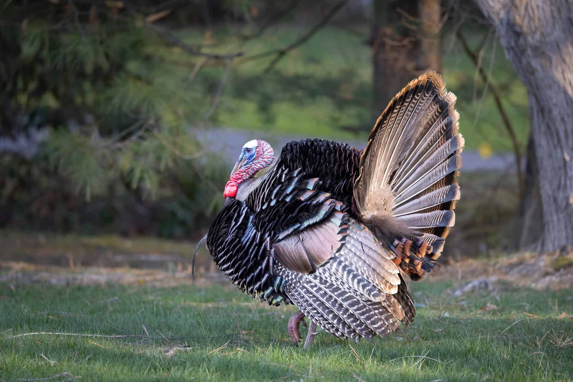
A century ago, wild turkeys were a rare sight in many parts of the United States. Populations were estimated to be 200,000 or less across the country. Through science-based conservation and management, education, and sound policy, the National Wild Turkey Federation (NWTF) helped grow turkey (Meleagris gallopavo) populations to over 6 million.
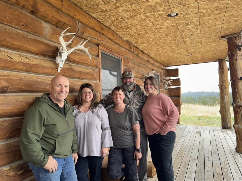
In this episode,Katie Perkins and Ed Arnett of The Wildlife Society join Mark Hatfield, former national director of science and planning, Jen Davis, hunting and shooting R3 coordinator for Michigan and Teresa Carroll, education and outreach program coordinator of the NWTF at turkey camp to share how their work has contributed to this remarkable recovery.
Through a mentored hunt, we learn what it took to bring wild turkey populations back from the brink and the role hunting can play in wildlife conservation.
“Our Wild Lives” is The Wildlife Society’s weekly podcast, sharing compelling stories from wildlife professionals doing critical work around the world. Your hosts, Katie Perkins and Ed Arnett, of The Wildlife Society, bring you thought-provoking conversations with leading experts and emerging voices.
New episodes are released weekly wherever you get your podcasts. Please email comms@wildlife.org with feedback or future episode suggestions.
From left to right, Ed Arnett, Teresa Carroll, Jen Davis, Mark Hatfield and Katie Perkins at a turkey hunt camp. Credit: Katie Perkins
Gone may be the days when a farmhand paced the barn with a clipboard in hand to assess the health of a turkey flock. As the poultry industry faces labor shortages, rising disease concerns and pressure to meet welfare standards, researchers at The Pennsylvania State University are testing a modern alternative: drones, cameras and artificial intelligence.
In a first-of-its-kind study, researchers at Penn State’s Poultry Education and Research Center flew drones over groups of domestic turkeys (Meleagris gallopavo). They used drone footage and a You Only Look Once (YOLO) computer vision AI model to identify eight behaviors: standing, sitting, feeding, drinking, huddling, perching, wing flapping and dead.
“This work provides proof of concept that drones plus AI can potentially become an effective, low-labor method for monitoring turkey welfare in commercial production,” said Enrico Casella, an assistant professor at Penn State. “It lays the groundwork for more advanced, scalable systems in the future.”
Although promising, the model still needs a little more time in the oven. Currently the model struggles to distinguish similar behaviors and to separate individual birds within the flock. And while it performed well in controlled, lower-density pens, the real challenge will be commercial barns, where crowding may make detection more difficult.
Bounding boxes around individual behaviors within each frame help to train the AI model. Credit: The Pennsylvania State University
Drones with cameras and AI models could transform flock management by offering flexible, wide-area, non-invasive monitoring that gives insight into bird health, behavior, and environmental conditions. It could improve daily welfare assessments so you can feel better about the bird on your plate.
The federal environmental watchdog is slashing jobs while moving to sharply limit the scope of federal waterway protections—two actions will likely affect wildlife and wetland habitats.
WOTUS are protected under the Clean Water Act, which requires federal permits for pollutant discharges and for dredge-and-fill activities that could degrade those waters.
The 2023 Sackett v. EPA ruling limited the federal government’s authority by narrowing which wetlands and streams fall under the Clean Water Act, requiring that a wetland be “indistinguishably part” of a larger water body. The agency asserts that the proposed rule is more in line with the Supreme Court’s Sackett v. EPA decision. The proposed WOTUS definition refocuses federal jurisdiction under the Clean Water Act on relatively permanent, standing, or continuously flowing bodies of water, such as streams, oceans, rivers, and lakes, as well as wetlands directly connected to them. It also proposes:
That jurisdictional tributaries must connect to traditional navigable waters either “directly or through other features that provide predictable and consistent flow,” removing those that do not meet the continuous-surface-connection test.
The use of terms like “wet season” to help decide whether a water body qualifies under WOTUS.
Reductions in the number of permafrost wetlands eligible for federal protection
The proposed changes to the definition are intended to provide clarity and consistency. If passed, the rule changes will limit the wetlands and temporarily flowing waters that receive protection under the Clean Water Act, with potential implications for wildlife dependent on these sources of water. The agency published the proposed rule on November 20, 2025, and will accept public comments until January 4, 2026. The agencies will hold two in-person public meetings, with an option for virtual participation which will be posted online.
EPA staff cuts
At a moment when the Administration is restructuring research offices and tightening its regulatory reach, it raises questions about the EPA’s capacity to implement policy like the Clean Water Act amid upheaval.
The proposed rule arrives as the federal government is implementing one of the most significant workforce shake-ups in its history. More than 2,600 agency employees have accepted the Administration’s “Fork in the Road program,” which gives federal workers the option of deferred resignation. More than 17% of the agency’s staff has left or will leave, mirroring a broader loss of 154,000 federal workers as part of the Administration’s mass resignation plan to reduce the federal government’s payroll.
Concurrently, the Office of Research and Development closed on October 3, and the EPA launched the new, smaller Office of Applied Science and Environmental Solutions.
It remains to be seen if a leaner EPA can uphold the Clean Water Act as its jurisdiction narrows.
Join fellow TWS members in supporting this year’s Giving Tuesday campaign. The funds from this year’s campaign will go to support securing a future where wildlife and the people who protect it can thrive through policy engagement.
A vast cavern rediscovered in 2008 helped transformed Vietnam’s Phong Nha–Kẻ Bàng National Park from an ecosystem impacted by poaching and logging into a thriving hub of sustainable tourism, a rare success story.
“There was no work,” remembered Phan Văn Thín, who as a teenager supported himself through jungle work despite the decline of many species at the time. As UNESCO recognition expanded and conservation enforcement tightened, hundreds of former hunters traded their hunting equipment for helmets and harnesses, finding steady work guiding visitors through the region’s 400-million-year-old karst labyrinth.
Fifteen years later, wild species began reappearing in growing numbers. Elusive animals like the saola (Pseudoryx nghetinhensis), an antelope so rarely seen that it is nicknamed the “Asian Unicorn,” are now found in Phong Nha–Kẻ Bàng.
National parks in Vietnam have limited resources to measure wildlife population numbers. But UNESCO recently declared a transboundary world heritage site in the area that stretches past the western border and into Laos. Conservationists hope this expansion will increase the benefits of the park, reshaping livelihoods and reviving ecosystems across country boundaries.
Several key conservation programs in the U.S. Department of Agriculture have been funded in appropriations language that passed with the recent spending bill.
The continuing resolution (H.R. 5371) passed through Congress after a record 44-day shutdown. While the administration proposed significant cuts to, or complete elimination of, funding for many of these programs, Congress has provided relatively stable appropriations for the 2026 fiscal year compared to the previous fiscal year.
The NRCS Conservation Technical Assistance Program, which connects private landowners with opportunities to improve the health of their lands while conserving wildlife and their habitats, was one program slated for funding elimination in the President’s FY2026 budget request. It is now being funded, though final FY2026 appropriations for the program were $697.6 million compared to the $776.5 million at FY2025 levels.
The administration had also proposed to eliminate funding for the Renewable Resources Extension Act, which funds extension forestry and natural resource activities at land grant universities. But the program received $4 million in FY2026 appropriations, level with funding the previous fiscal year.
As we’ve come to see over the past year, the passage of appropriations bills is just part of the federal conservation program funding puzzle. When federal dollars are appropriated but fail to reach their intended programs, the issue at hand is often one of impoundment—the effective withholding of congressionally-approved dollars from obligation or expenditure.
For conservation professionals, even when policy wins result in an appropriation, real ecological outcomes still depend on timely obligation, allocation, and dispersal of funding. If those steps are delayed—or funds are held back for policy, budgetary, or administrative reasons—the gap between legislative intent and field implementation widens, meaning stewardship targets slip, partnerships stall, and measurable conservation progress remains unrealized.
Earlier this year, TWS chapters, sections and working groups identified conservation funding as the most important policy priority for The Wildlife Society. TWS is committed to championing diverse, sustainable funding sources for wildlife conservation. Visit the Conservation Affairs Network Policy Toolkit to learn more about using your voice to engage with the U.S. congressional appropriations process.
Hungry birds avoid snacking on spotted lanternflies after the insects have been feasting on tree of heaven plants. Both invasive species from Asia, the tree of heaven (Ailanthus altissima) is the spotted lanternfly’s (Lycorma delicatula) preferred host. Researchers from The Pennsylvania State University’s College of Agricultural Sciences placed insects on top of boxes occupied by house wrens (Troglodytes aedon) and found that birds were less likely to choose lanternflies reared on tree of heaven. They also ground up adult lanternflies reared with and without the plant and incorporated them into bird feeders. The bird feed with lanternflies that hadn’t eaten tree of heaven had more visits from birds compared to the other bird feed. The researchers isolated toxins called quassinoids from the lanternflies, which they think the insects are getting from tree of heaven. In an interview with the university, coauthor Anne Johnson said the results suggest that “the insects that consume this plant are less tasty, thereby providing some chemical defenses against avian predators.” Despite the distaste, some birds and other insects still feed on lanternflies in the wild, and the researchers next step is to better understand the conditions in which this predation occurs.
A TWS member since 1959, Hornocker helped pioneer the practice of marking individual animals and had a hand in the first life history studies of many large carnivores. From grizzlies (Ursus arctos horribilis) and cougars (Puma concolor), to bobcats (Lynx rufus) and river otters (Lontra canadensis), Hornocker has seen it all. His stories reveal the fundamental base for which much of the wildlife profession now works off.
“Our Wild Lives” is The Wildlife Society’s weekly podcast, sharing compelling stories from wildlife professionals doing critical work around the world. Your hosts, Katie Perkins and Ed Arnett, of The Wildlife Society, bring you thought-provoking conversations with leading experts and emerging voices.
New episodes are released weekly wherever you get your podcasts. Please email comms@wildlife.org with feedback or future episode suggestions.