Wetland News* Archives – 2014
December
USACE requests review of National Wetland Plant List ratings, additions, deletions
 In 2012, an extensive update of the National Wetland Plant List (NWPL) was finalized. In an effort to continue improving the quality of wetland ratings on the NWPL, the NWPL’s national panel is releasing an online questionnaire designed to identify those plant species for which wetland ratings may need revision (i.e., OBL – obligate, FACW – facultative wetland, etc…), as well as species that should be considered for addition and/or deletion from the list. The questionnaire is open to any agency, institution, or individual who cares to submit information on one or more plant species with wetland ratings that may need further review. Questionnaires will be accepted November 10, 2014 through January 31, 2015. A link to the questionnaire and an example of a completed questionnaire for an individual plant species can be found on the NWPL website. To read the full announcement, click here.
Media mogul gives Clemson $3.3 million for waterfowl research on coast
Clemson University will use a $3.3 million gift to establish a waterfowl and wetlands research center in coastal South Carolina. The university announced Monday that media and automotive services conglomerate executive James C. Kennedy donated the money. The center would be the first endowed waterfowl conservation site of its kind in the Atlantic Flyway of the eastern United States, the university said in a news release. The endowment will help pay for teaching, research and landowner outreach in the flyway. For more on this story, click here.
APHIS uses detection dogs for nutria eradication
 Keeva and Rex are the two newest recruits in the efforts to protect Chesapeake Bay wetlands by eradicating invasive nutria from the Delmarva Peninsula. They have been trained to detect the invasive creatures, and will be the key to accomplishing the last phase of The Chesapeake Bay Nutria Eradication Project (CBNEP). Only these two newest workers aren’t people – they’re dogs that have been trained at the National Detector Dog Training Center. Nutria are semi-aquatic rodents, similar to muskrats. Devouring up to 25 percent of their body weight in plants and roots per day, they have devastated Chesapeake Bay wetlands, turning them into barren mud flats. For more on this story, click here.
Rufa red knot listed due to climate change
 After a population drop of about 75 percent since the 1980s, the U.S. Fish and Wildlife Service (FWS) announced last week that it has listed the rufa red knot (Calidris canutus rufa) as threatened under the Endangered Species Act. Threats to the rufa subspecies of the red knot include climate change which is affecting the bird’s food supply, the timing of its migration, as well as its breeding habitat and natural predator cycles in the Arctic. The shorebird also is losing areas along its range due to sea level rise, shoreline projects, and development while a primary factor in its recent population decline was reduced food supplies in Delaware Bay due to commercial horseshoe crab harvesting. On wingspans of 20 inches, some rufa red knots fly more than 9,300 miles from wintering habitats in the U.S., Caribbean, and South America to the Canadian Arctic every spring and repeat the trip in reverse every autumn, making this bird one of the longest-distance migrants in the animal kingdom. In making its decision, the FWS analyzed the best available data in more than 1,700 scientific documents, and considered issues raised in more than 17,400 comments provided during 130 days of public comment periods and three public hearings. For more information on this subspecies, click here.
November
TWS, SWS, DU release comments on EPA’s Waters of the United States proposed rule

 The Wildlife Society (TWS), Society of Wetland Scientists (SWS), and Ducks Unlimited (DU) each submitted comments on the Environmental Protection Agency’s (EPA) proposed changes to policies regarding implementation of the Clean Water Act (CWA). The proposed rule is intended to clarify long standing confusion over which water bodies are under jurisdiction of the CWA. The EPA originally proposed the “Definition of `Waters of the United States’ (WOTUS) Under the Clean Water Act” rule in April, but extended the comment period twice to allow organizations and individuals more time to read and interpret the proposal before making comments. The comment period closed Friday, November 14. Members of TWS’ Wetlands Working Group played a major role in developing TWS’s comments using their expertise on wetlands and the wildlife dependent on wetlands habitats. The recommendations focused on clarifying some of the definitions within the rule such as “significant nexus” which describes how wetlands are connected and “floodplain,” which describes the process by which the EPA will delineate areas that flood periodically. TWS suggested tweaking some of the definitions to be more clear and better reflect current scientific knowledge so the EPA can make consistent, accurate and timely designations. For the original TWS website on this story, click here. For more information on WOTUS from DU, click here.
Deforestation not always bad news for wetlands
Deforestation is both a boon and a bane for wetlands, according to new research by The University of Queensland published in Science. The study found that human impacts on the environment, such as deforestation, do no always have negative consequences, and can provide positive outcomes for biodiversity. The researchers analyzed a global database of 245,000 wetlands and found that water levels in nine to 12 percent, including 20 to 40 percent of wetland protected under the Ramsar Convention on Wetlands of International Importance, were increased due to human deforestation activities. Increased water inflow can not only increase water depth and persistence in existing wetlands, but can also create new wetlands. For more on this story, click here.
House passes bill to increase price of duck stamps
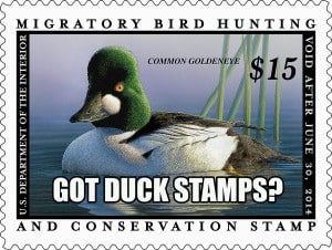
 A bill to increase the price of duck stamps from $15 to $25 passed the House on Tuesday with very little resistance. H.R. 5069 was passed out of the House Natural Resources Committee in July, but has had to wait for action on the floordue to the long fall recess. The legislation enjoys both bipartisan support and public backing from the administration. An identical bill (S. 2621) has been introduced in the Senate where it awaits committee action. The Wildlife Society signed a coalition letter supporting an increase in the price of duck stamps earlier this year. Resistance to the bill stems from language that requires the extra $10 only be used for conservation easement purchases as oppose to land acquisition. For more on this story, click here.
United Nations organization extends protection to 31 migratory species
 Marine mammals, sharks and rays, polar bears, and some birds are among the 31 species that will get greater protection under a deal reached earlier this week by more than 100 countries at a meeting of the Convention on the Conservation of Migratory Species of Wild Animals (CMS), a U.N. body. The new initiatives were approved during tense negotiations at CMS’s annual conference, held in Quito, Ecuador from 3 to 9 November. By adding the animals to the list of species protected under the CMS, nations agree to devise plans to protect the animals while they are within their borders. Among many policies set during the meeting, a resolution called for phasing out lead shot—commonly used in shotgun shells for bird hunting—over the next 3 years. Another called for eliminating the veterinary drug diclofenac, which kills vultures and other birds, as well as rodenticides, insecticides, and poison bait. Delegates also adopted guidelines on how to better deploy renewable energy technologies, such as wind turbines, solar panels, and dams, so that they do not harm wildlife. For more on this story, click here.
October
The most ambitious environmental lawsuit ever: Oil & gas companies and Louisiana’s wetlands
Each hour, Louisiana loses about a football field’s worth of land. Each day, the state loses nearly the accumulated acreage of every football stadium in the N.F.L. The wetlands, apart from their unique ecological significance and astounding beauty, buffer the impact of hurricanes that threaten not just New Orleans but also the port of South Louisiana, the nation’s largest; just under 10 percent of the country’s oil reserves; a quarter of its natural-gas supply; a fifth of its oil-refining capacity; and the gateway to its internal waterway system. Where does it go, this vanishing land? It sinks into the sea. The Gulf of Mexico is encroaching northward, while the marshes are deteriorating from within, starved by a lack of river sediment and poisoned by seawater. The reduction of sediment in the Mississippi, the construction of levees and the oil and gas wells “created a situation akin to taking the block of ice out of the freezer, so it begins to melt.” Dredging canals and pipelines “is akin to stabbing that block of ice with an ice pick.” Last year, industry executives were asked to pay damages in the form of the most ambitious, wide-ranging environmental lawsuit in the history of the United States. For more on this story, click here.
EPA and ACE extend comment period on proposed WOTUS rule
 The U.S. Environmental Protection Agency (EPA) and U.S. Army Corps of Engineers (ACE) have again extended the comment period on the proposed “Definition of the ‘Waters of the United States’ Under the Clean Water Act” (WOTUS) rule to Friday, November 14, 2014. This extension has been provided in response to requests for additional time to comment and to provide the opportunity to comment on the Science Advisory Board (SAB) review of peer review comments on the “Connectivity of Streams and Wetlands to Downstream Waters: A Review and Synthesis of the Scientific Evidence” report. The EPA will not finalize the WOTUS rule until it has fully reviewed the SAB peer review comments and finalized the scientific connectivity report. The SAB’s September 30, 2014 comments on the proposed rule can be found here. The full Federal Register publication discussing the proposed rule can be found here. More information on the WOTUS ruling and the ability to comment can be found here.
As Alaska warms, black brant forgo a 3,300 mile migration
In the past, Izembek National Wildlife Refuge (located on the southwestern tip of Alaska’s peninsula) was just a stopover in the black brant’s autumn journey down North America’s western coastline. After a short stay to fatten up, the sated sea geese would lift off together and head south on a 3,300-mile, nonstop migration to Mexico’s Baja California. But nature doesn’t follow that predictable course anymore. Scientists have documented that increasing numbers of black brant are skipping that far southern migration and staying in Alaska instead. Fewer than 3,000 wintered in Alaska before 1977. In recent years, however, more than 40,000 have remained north, with as many as 50,000 staying there last year, during the most ice-free winter that Izembek had seen in more than a decade. For more on this story, click here.
United Nations releases guidebook on responsible peatland management
![]() The Food and Agriculture Organization of the United Nations released the guidebook “Towards climate-responsible peatlands management” concurrently with a webinar on the same topic. The following is from the Executive Summary: Peatlands support a large range of habitats and provide a home for unique biodiversity. Along with storing large quantities of carbon, peatlands also play an important role in the retention, purification and release of water and in the mitigation of droughts and floods. They provide a source for fish, non-timber forest products and other goods and services. Peat has also been extracted to generate energy and supply growing media to the horticulture industry. Many natural peatlands have been converted and drained to allow for conventional agriculture and forestry. When drained, peatlands become net sources of greenhouse gas (GHG) emissions. Because of drainage, organic soils are currently the third-largest emitter of GHGs in the Agriculture, Forestry and Land Use (AFOLU) sector; they emit almost one gigatonne of CO2 equivalent (CO2-eq), which represents 10 percent of the total AFOLU emissions. High GHG emissions are particularly evident when oil palm and pulp wood production are carried out under deep drainage and high temperature on tropical peatlands. Peatland drainage also leads to lowering the height of the land surface, a process known as land subsidence, and it increases the discharge of dissolved and particulate carbon downstream, reducing water quality in aquatic ecosystems. Over time, peatland drainage causes the vegetation cover to change and biodiversity to be lost. Fires become more frequent. There can be increases in salt water intrusion, droughts and soil erosion, all of which eventually reduce agricultural productivity.
The Food and Agriculture Organization of the United Nations released the guidebook “Towards climate-responsible peatlands management” concurrently with a webinar on the same topic. The following is from the Executive Summary: Peatlands support a large range of habitats and provide a home for unique biodiversity. Along with storing large quantities of carbon, peatlands also play an important role in the retention, purification and release of water and in the mitigation of droughts and floods. They provide a source for fish, non-timber forest products and other goods and services. Peat has also been extracted to generate energy and supply growing media to the horticulture industry. Many natural peatlands have been converted and drained to allow for conventional agriculture and forestry. When drained, peatlands become net sources of greenhouse gas (GHG) emissions. Because of drainage, organic soils are currently the third-largest emitter of GHGs in the Agriculture, Forestry and Land Use (AFOLU) sector; they emit almost one gigatonne of CO2 equivalent (CO2-eq), which represents 10 percent of the total AFOLU emissions. High GHG emissions are particularly evident when oil palm and pulp wood production are carried out under deep drainage and high temperature on tropical peatlands. Peatland drainage also leads to lowering the height of the land surface, a process known as land subsidence, and it increases the discharge of dissolved and particulate carbon downstream, reducing water quality in aquatic ecosystems. Over time, peatland drainage causes the vegetation cover to change and biodiversity to be lost. Fires become more frequent. There can be increases in salt water intrusion, droughts and soil erosion, all of which eventually reduce agricultural productivity.
September
New research on amphibian chytrid fungus occupancy and detection in wetlands
 The Amphibian Research and Monitoring Initiative (ARMI) released new research on the amphibian chytrid fungus, an aquatic fungus implicated as a contributor to amphibian declines worldwide. Most research has focused on the dynamics of the pathogen in its amphibian hosts, with little emphasis on the ecology of the fungus in the environment. Investigators looked at patterns of amphibian chytrid fungus occupancy and density in amphibian habitats using occupancy models, powerful tools for estimating site occupancy and detection probability. This study provided evidence that the fungus occurs in the environment year-round, and its density varies seasonally. Amphibian chytrid fungus was detected in 47% of sites sampled, but estimated that it occupied 61% of sites, highlighting the importance of accounting for imperfect detection. When the amphibian chytrid fungus was present, there was a 95% chance of detecting it with four samples of 600 ml of water or five samples of 60 mL. Their findings provide important baseline information to advance the study of Bd disease ecology, and advance our understanding of amphibian exposure to free-living Bd in aquatic habitats over time. For more on this story, click here.
NRCS helping landowners restore 1,638 more acres of wetlands in Missouri
![]() The USDA’s Natural Resources Conservation Service (NRCS) will be providing about $5.8 million in financial and technical assistance to help landowners voluntarily restore 1,638 more acres of wetlands in Missouri, mostly along the Mississippi River and the Missouri River. The funding is part of a $328 million national effort by USDA to protect and restore key farmlands, grasslands and wetlands through NRCS’ Agricultural Conservation Easements Program (ACEP). The program is part of the 2014 Farm Bill. It consolidates three former NRCS programs – the Farm and Ranch Lands Protection Program, Grassland Reserve Program and Wetlands Reserve Program. For more on this story, click here.
The USDA’s Natural Resources Conservation Service (NRCS) will be providing about $5.8 million in financial and technical assistance to help landowners voluntarily restore 1,638 more acres of wetlands in Missouri, mostly along the Mississippi River and the Missouri River. The funding is part of a $328 million national effort by USDA to protect and restore key farmlands, grasslands and wetlands through NRCS’ Agricultural Conservation Easements Program (ACEP). The program is part of the 2014 Farm Bill. It consolidates three former NRCS programs – the Farm and Ranch Lands Protection Program, Grassland Reserve Program and Wetlands Reserve Program. For more on this story, click here.
California drought: Rice farmers rent crucial ‘pop-up’ wetlands for migrating birds
 With California’s enduring drought keeping more than four-fifths of the state in severe drought conditions, millions of birds starting their annual migration south will have a much harder than usual time finding rest and feeding stops. Using data to determine where and when migratory birds need habitat, the Nature Conservancy is spending “in the six-digit range” to pay farmers who have submitted bids to keep their rice fields flooded during the key migration periods of September and October and early spring 2015. Known as a reverse auction, selected farmers are then paid to keep their land flooded, often using private wells. For the upcoming year the conservancy accepted 80 of 160 bids, securing 14,000 acres of wetland. For more on this story, click here and here.
Storm resiliency grants will help wetland restoration at National Wildlife Refuges
 Of the 54 projects along the Atlantic Coast that received $102.7 millions in grants as part of the Obama administration’s climate action plan to make local communities more resilient against future storms, 4 directly benefit the National Wildlife Refuge System. Nearly $18 million will fund science-based solutions to restore wetlands and other natural areas, including an estimated 6,634 acres of wetlands and marshes, 225 acres of beach, 364 acres of riparian buffers, and 16 miles of streams. The efforts will also open 287 miles of streams to fish passage and restore 147 acres of flood plain. To learn more, click here.
August
My Healthy Wetland: A handbook for private wetland owners
A full color handbook has been designed for private wetland landowners by the Wisconsin Wetlands Association. The My Healthy Wetland handbook provides basic information about what wetlands are, why they matter, and how to care for them in an attractive, accessible format. It’s a quick read, full of information about wetlands and the actions landowners can take to keep their wetlands healthy and teeming with wildlife. Although this first edition of the handbook is geared for the eastern portion of Wisconsin (throughout counties in the Lake Michigan basin), private landowners across the region can take advantage of the information provided. For more information and to order the handbook, click here.
Many Coastal Wetlands Likely to Disappear this Century
 Many coastal wetlands worldwide — including several on the U.S. Atlantic coast — may be more sensitive than previously thought to climate change and sea-level rise projections for the 21st century. U.S. Geological Survey scientists made this conclusion from an international research modeling effort titled “Limits on the Adaptability of Coastal Marshes to Rising Sea-Level” published in the journal Geophysical Research Letters, a publication of the American Geophysical Union. Scientists identified conditions under which coastal wetlands could survive rising sea level. Using a rapid sea-level rise scenario, most coastal wetlands worldwide will disappear near the end of the 21st century. In contrast, under the slow sea-level rise projection, wetlands with low sediment availability and low tidal ranges are vulnerable and may drown. However, in the slow sea-level rise projection, wetlands with higher sediment availability would be more likely to survive. For more on this story, click here.
Man-made wetlands turn wastewater into tap water
The 2,000-acre wetland system in Fairfield, Texas converts what is mainly treated wastewater that would otherwise flow into the Gulf of Mexico into an additional 65,000 gallons per day feeding the Richland-Chambers Reservoir — a significant contribution in a state enduring prolonged drought. At $75 million, the wetlands system cost far less to build than traditional filtering infrastructure. It reroutes Trinity River water — which in July was mostly treated wastewater that entered the waterway 100 miles upstream — into large pools where the sediment settles, Darrel Andrews, the water district’s environmental director, said. From there, it passes through areas abundant with ragweed, hackberry and other plants where many water birds roost. Along the way, microbes and plants filter out the nitrates and phosphorous from the water, which is eventually released into the reservoir. For more on this story, click here.
Elevated pesticide concentrations found in frogs and wetlands in an agricultural landscape
 Researchers from the U.S. Geological Survey (USGS) and Iowa State University examined the presence of pesticides and nutrients in water and sediment as indicators of habitat quality and assessed the accumulation of pesticides in tissue of two native amphibian species Pseudacris maculata (chorus frogs) and Lithobates pipiens (leopard frogs) at six wetlands (3 restored and 3 reference) in Iowa. Restored wetlands are positioned on the landscape to receive subsurface tile drainage water while reference wetlands receive water from overland run-off and shallow groundwater sources. Concentrations of the pesticides frequently detected in water and sediment samples were not different between wetland types. The herbicide atrazine was detected in 100% of the water samples and in some instances at concentrations high enough to potentially cause reproductive effects in leopard frogs. Nutrient concentrations were higher in the restored wetlands but lower than concentrations thought to cause lethality in frogs. Seventeen pesticides were detected in tissue samples with concentrations ranging from 0.08 to 1,500 μg/kg wet weight. No significant differences in pesticide concentrations were observed between species, although concentrations tended to be higher in leopard frogs compared to chorus frogs, possibly because of differences in life histories. Their results provide information on habitat quality in restored wetlands that will assist state and federal agencies, landowners, and resource managers in identifying and implementing conservation and management actions for these and similar wetlands in agriculturally dominated landscapes.
July
N.A. duck populations remain strong, wetland conditions good, according to 2014 USFWS duck survey
 Duck populations have increased in overall abundance over last year, and their habitat conditions have improved, according to the U.S. Fish and Wildlife Service’s Trends in Duck Breeding Populations 2014 report released today. These conclusions are based on the 2014 Waterfowl Breeding Population and Habitat Survey conducted by the U.S. Fish and Wildlife Service and Canadian Wildlife Service. The annual duck survey encompasses more than 2 million square miles of waterfowl habitat across Alaska, north-central and northeastern U.S. states, and south-central, eastern and northern Canada. The preliminary estimate for the total duck population is 49.2 million birds, an 8 percent increase over last year’s estimate of 45.6 million birds, and 43 percent above the long-term average.
Carbon storage in U.S. eastern ecosystems helps counter greenhouse gas emissions
 On the one-year anniversary of President Obama’s Climate Action Plan, Secretary of the Interior Sally Jewell today released a new report showing that forests, wetlands and farms in the eastern United States naturally store 300 million tons of carbon a year (1,100 million tons of CO2 equivalent), which is nearly 15 percent of the greenhouse gas emissions EPA estimates the country emits each year or an amount that exceeds and offsets yearly U.S. car emissions. In conjunction with the national assessment, today USGS also released a new web tool, which allows users to see the land and water carbon storage and change in their ecosystems between 2005 and 2050 in the lower 48 states. This tool was called for in the President’s Climate Action Plan. Wetlands, including coastal ones, which comprise only about 9 percent of the land cover in the region studied, account for nearly 13 percent of the region’s estimated annual carbon storage. They also have the second-highest rate of sequestration of all ecosystem types. Nutrients and sediments in rivers and streams flowing from terrestrial environments contribute significantly to the storage of carbon in eastern coastal sediments and deep ocean waters. For more on this story, click here.
Northwest and Hawai’i National Wildlife Refuges to phase out pesticide
 Federal wildlife refuges in the Northwest and Hawaii will phase out a class of pesticides that are chemically similar to nicotine because they pose a threat to bees and other pollinators key to crop growth. The region covering Oregon, Washington, Idaho and Hawaii is the first in the agency to ban neonicotinoids. There is room for exemptions, but the goal is to phase out the pesticides by January 2016, U.S. Fish and Wildlife Service (USFWS) spokeswoman Miel Corbett said Monday. Neonicotinoids are commonly applied as a coating on seeds such as corn, wheat, barley and soybeans planted on refuges both as commercial crops and to benefit wildlife, according to USFWS documents on the ban. More than 13 square miles of national wildlife refuges were planted with crops using neonicotinoids in 2013. For more on this story, click here.
USACE proposes revisions to 1987 Manual regarding hydrophytic vegetation
 Two recent publications by Robert Lichvar and Jennifer Gillrich of the US Army Corps of Engineers (USACE) propose revisions to the 1987 Corps Wetland Delineation Manual. These publications address technical issues identified by the National Technical Committee for Wetland Vegetation (NTCWV) regarding hydrophytic vegetation, one of three factors used to delineate wetlands. To determine whether vegetation is predominantly hydrophytic or nonhydrophytic, plant species are assigned a wetland indicator status (OBL, FACW, FAC, FACU, UPL) and a mathematical method, either the Dominance Ratio (DR) or Prevalence Index (PI). Findings in the first publication indicate discrepancies between determinations using the DR and the PI, and that both produce significantly fewer hydrophytic determinations than the Hydrophytic Cover Index (HCI). The HCI was determined to be more accurate and consistent than the DR and PI and is recommended for future USACE wetland delineations. The second publication tested vegetation plot design and methods using the HCI method. Researchers found no difference in hydrophytic determinations between nested circular 9m and 2m radii plots that are currently used in the 1987 Manual versus a simpler 10m x 2m rectangle plot design. Also, they found that it was not necessary to identify more than 80% of the total vegetative cover to species level to obtain an accurate HCI determination.
June
Water legislation promotes floodplains and wetlands
 On June 10, 2014, President Barack Obama signed H.R. 3080 – Water Resources Reform and Development Act of 2014, authorizing 34 projects — including a few that benefit Montana — at an expected cost of around $12.3 billion over the coming decade. Tucked within the 2014 bill is a provision introduced last year by former Sen. Max Baucus that could help Montana streams withstand the effects of floods and drought, which are more likely to occur as climate change causes weather swings to become more extreme. Projects approved under the law must incorporate and protect natural processes, such as restoring wetlands and floodplains that can contain high water rather than using riprap to harden banks against floodwaters. For more on this story, click here.
New report warns about effects of accelerating mangrove deforestation
 The United Nations Environment Programme (UNEP) has launched a new report titled ‘The Importance of mangroves to people: A call to action” in which it warns that the deforestation of the planet’s mangroves was exceeding average global forest loss by a rate of three to five times, resulting in economic damages of up to $42 billion annually and exposing ecosystems and coastal habitats to an increased risk of devastation from climate change. The complex network of mangrove roots can help reduce wave energy, limiting erosion and shielding coastal communities from the destructive forces of tropical storms. Mangrove ecosystems are often an essential source of seafood for both subsistence consumption and the local and national seafood trade, in addition to providing other materials such as firewood and timber, which support the livelihoods of thousands of coastal communities. Beyond their direct benefits, mangroves also play an important role in global climate regulation. On average, they store around 1,000 tonnes of carbon per hectare in their biomass and underlying soil, making them some of the most carbon-rich ecosystems on the planet.
Klamath Basin experiencing severe droughts, National Wildlife Refuges battle for water
The nation’s original waterfowl refuge may be too dry this year to provide much hospitality for migratory birds arriving in the Klamath Basin. Lower Klamath National Wildlife Refuge in northern California along the Oregon border is estimated to have fewer than 2,000 acres of wetlands flooded right now — only a small fraction of the 80,000 acres that were historically wetlands. And this summer, the Lower Klamath refuge will essentially be a cracked lakebed. There are a couple reasons for this. One, it’s a drought year. Two, the refuges are among the lowest priorities for receiving water. For more on this story, click here.
USFWS and PPJV release new Status and Trends of Prairie Wetlands report
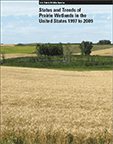 The Status and Trends of Prairie Wetlands in the United States 1997 to 2009 was released this month as a joint effort by the U.S. Fish and Wildlife Service (USFWS) and Prairie Pothole Joint Venture (PPJV). This report estimates that 6,427,350 acres of wetlands remained in the Prairie Pothole Region (PPR) in 2009, which represents 5.8 % of the total wetland area found in the conterminous U.S. in 2009. Between 1997 and 2009, wetlands in the PPR declined by an estimated 74,340 acres – an average annual net loss of 6,200 acres – with an estimated 40 % of emergent wetland area lost or converted to deepwater lake systems or open-water ponds. The number of wetland basins declined in every state in the PPR with the exception of Montana that experienced a gain in wetland basins of <1.0 percent. While North Dakota lost the largest number of wetland basins (51,780), Minnesota sustained the largest percentage loss of remaining wetland basins declining by over 18 percent. Iowa lost 14 percent of the remaining basin numbers and both North and South Dakota each lost 3 percent. Click here for a fact sheet and Q&As.
May
Wetland Program Plans Handbook helps states and tribes develop wetland program plans
 The Association of State Wetland Managers (ASWM) recently created the Wetland Program Plan Handbook that provides states and tribes with guidance and resource materials to support the development of wetland program plans. This handbook is the culmination of a two-year project carried out by the ASWM through a grant from the U.S. Environmental Protection Agency with additional support from the McKnight Foundation and The Orchard Foundation. Wetland Program Plans can establish priorities, set short and long term program development goals and provide states and tribes with a blueprint for future action. A wetland plan must be tailored to the unique opportunities and challenges that occur in a given state or on tribal lands. Therefore this document does not provide a recipe for developing a wetland program plan. Rather, it provides information about the different components that can be part of a plan and explores how a state or tribe might develop a plan.
New study blames thawing wetlands for increase in greenhouse gas emissions
A surprising recent rise in atmospheric methane likely stems from wetland emissions, suggesting that much more of the potent greenhouse gas will be pumped into the atmosphere as northern wetlands continue to thaw and tropical ones to warm, according to a new international study led by a University of Guelph researcher. The study supports calls for improved monitoring of wetlands and human changes to those ecosystems – a timely topic as the Intergovernmental Panel on Climate Change (IPCC) prepares to examine land use impacts on greenhouse gas emissions, says Prof. Merritt Turetsky, Department of Integrative Biology. For more on this story, click here.
National Wetlands Awards presented during American Wetlands Month
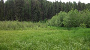 May 2014 marks the 24th anniversary of American Wetlands Month, during which time the National Wetlands Awards are presented annually to individuals who have excelled in wetlands protection, restoration, and education. The program is administered by the Environmental Law Institute and supported by the U.S. Environmental Protection Agency, U.S. Fish and Wildlife Service, U.S. Forest Service, Natural Resources Conservation Service, NOAA Fisheries, and the Federal Highway Administration. Take a minute to congratulate the award winners for their outstanding contributions!
USFWS announces completion of National Wetlands Database
 To coincide with American Wetlands Month, the U.S. Fish and Wildlife Service is announcing the completion of the most comprehensive and detailed U.S. wetland data set ever produced, capping a 35-year effort by the Service to map the extent of the nation’s wetlands. The Wetlands Inventory Mapper has digitally mapped and made publicly available wetlands in the lower 48 states, Hawaii and dependent territories, as well as 35 % of Alaska. It is an invaluable aid to landowners, developers, government planners and permitting authorities, conservation organizations and academic institutions in their collective efforts to ensure wetland conservation and inform economic development. Wetlands data can be viewed through the Mapper, Web Map Services, with Google Earth, or files can be directly downloaded for use in GIS.
April
Invasive Phragmites australis found to negatively affect reptiles and amphibians
 “In recent decades herpetofauna populations have declined throughout the Great Lakes region due largely to habitat loss, degradation and fragmentation. In Michigan, more than 60% of all species of amphibian and reptile are considered Species of Greatest Conservation Need by the Michigan Department of Natural Resources. Habitat for herpetofauna and other wildlife within the Great Lakes region is degrading rapidly due to a variety of factors including the highly invasive plant Phragmites australis, also known as the common reed, which grows in dense monoculture stands and dominates local plant communities. It is known that Phragmites fragments natural reptile and amphibian habitats by creating physical barriers to movement across the landscape and crowding out and shading necessary habitat components, such as nesting and basking areas”. The Michigan Department of Environmental Quality funded research in the Saginaw Bay area from 2011 to 2013 which “revealed the negative effects that habitat degradation associated with Phragmites is having on local amphibian and reptile populations and the overall quality of coastal habitats within the region. This novel work, which has been published in the Journal of Great Lakes Research demonstrates a need for the restoration of Great Lakes coastal habitat including a focus on the eradication of Phragmites“. For more on this story, click here.
Senator Paul introduces bill to cut back EPA’s authority to regulate wetlands
 Sen. Rand Paul (R-KY) introduced S.890, the Defense of Environment and Property Act, a bill designed to cut back the Environmental Protection Agency’s (EPA) authority to regulate wetlands. “This bill will restore common sense to federal jurisdiction over navigable waters, and place reasonable limitations on an agency that has become dangerously out of control,” Paul said in a statement. FreedomWorks, a conservative group that supports the legislation, explained the bill’s approach: The legislation “would redefine ‘navigable waters’ to explicitly clarify that waters must actually be navigable, exclude intermittent streams from federal jurisdiction and restrain the EPA and the Army Corps from regulating the definition of navigable waters without Congressional authorization.” This bill is nearly a replica of H.R. 3377 of the same name introduced in October 2013 by Rep. Thornberry (R-TX). These efforts come on the heels of an EPA scientific report titled “Connectivity of Streams and Wetlands to Downstream Waters: A Review and Synthesis of the Scientific Evidence” and proposed rule which seeks to clarify protection for streams and wetlands under the Clean Water Act (CWA) after recent Supreme Court decisions created some uncertainty about what the agency can regulate. For more on this story, click here.
Plowed Under: Native grassland in the northern plains is turning into farmland at a rate not seen since the 1920s
“Between 2006 and 2011, farmers in the Dakotas, Minnesota, Nebraska, and Iowa—the Western Corn Belt—had plowed up 1.3 million acres of native grassland in order to plant corn and soybeans”. Large scale land conversion in the prairies is now paralleling the deforestation in Brazil, Malaysia, and Indonesia and represents the most rapid loss of grasslands since tractors began breaking sod on the Great Plains in the 1920s. Several factors have played into this situation, but federal policies, such as the Renewable Fuel Standard expanded in 2007 to require oil companies to blend ethanol into the gasoline supply, have led to corn and soy commodity prices doubling between 2007 and 2012. This has incentivized farmers to plow up marginal cropland, wetlands, and about 5 million acres of land once in the Conservation Reserve Program (CRP)—more than all of Yellowstone, Everglades, and Yosemite national parks combined. According to this article by Jocelyn C. Zuckerman, further expansions of the crop-insurance program, decreases in conservation funding, and a lowered cap on CRP acreage enrollments all found in the Farm Bill passed this February seem to further support these trends.
NADS 6/ECNAW releases meeting abstracts
 The 6th North American Duck Symposium/Ecology and Conservation of North American Waterfowl (NADS 6/ECNAW) meeting held in Memphis, Tennessee from January 27-31, 2013 has recently put the meeting abstracts on its website. There were no abstracts for plenary papers but plenary and special session papers will comprise the proceedings from NADS 6/ECNAW: Ecology and Conservation of Waterfowl in the Northern Hemisphere (Special Issue 4, Wildfowl, to be published in late 2014). This symposium was held to synthesize current knowledge of waterfowl and their habitats and help guide science and conservation of these birds in the 21st century.
March
Carbon emissions, haze, and flooding may slow as palm oil and pulp wood industry giants commit to stopping peatland conversion
In Southeast Asia, about 25% of plantations are currently located on peat wetlands and some companies have more than 75% of their plantations on these carbon rich soils. Draining peatlands for palm oil and pulp wood production causes huge amounts of carbon emissions through peat oxidation and fires that cause public heath and economic issues. Peat drainage also causes severe soil subsidence which then cause flooding because 70% of the peatlands have their base under mid sea-level. Since pump operated drainage will not be feasible in these tropical environments with heavy precipitation, immense flooding will result in the loss of arable land and thousands of kilometres of coastline, like in Sumatra and Borneo. Not to mention, the cost for industries are dire. But an increasing number of palm oil and pulp wood producing giants are announcing their commitments to no deforestation and no peatland conversion. For more on this story, click here, here, and here.
Endangered Hawaiian Geese in Oahu for the first time in 300 years
 Hawaiian geese have just been spotted in the wild on the island of Oahu for the first time since the 1700s. A pair of the rare birds, also known as Nene, built a nest on the island. They also have a brood of three youngsters. The family of birds is living in a national wildlife refuge near Kahuku on the northern shore of the island. Their presence was first reported by officials from the U.S. Fish and Wildlife Service. For more on this story, click here.
EPA and Army Corps of Engineers Clarify Protection for Nation’s Streams and Wetlands
The EPA and Army Corps of Engineers today jointly released a proposed rule to clarify protection under the Clean Water Act (CWA) for streams and wetlands that form the foundation of the nation’s water resources. The proposed rule will benefit businesses by increasing efficiency in determining coverage of the CWA. Determining CWA protection for streams and wetlands became confusing and complex following Supreme Court decisions in 2001 and 2006. For nearly a decade, members of Congress, state and local officials, industry, agriculture, environmental groups, and the public asked for a rulemaking to provide clarity. The proposed rule clarifies protection for streams and wetlands. The proposed definitions of waters will apply to all CWA programs. It does not protect any new types of waters that have not historically been covered under the CWA and is consistent with the Supreme Court’s more narrow reading of CWA jurisdiction. For more on this story, click here.
Landmark Study Demonstrates Climate Benefits of Estuary Restoration
 Restore America’s Estuaries has released the findings of a groundbreaking study that confirms the climate mitigation benefits of restoring tidal wetland habitat in the Snohomish Estuary, located within the nation’s second largest estuary: Puget Sound. The study, the first of its kind, finds major climate mitigation benefits from wetland restoration and provides a much needed approach for assessing carbon fluxes for historic drained and future restored wetlands which can now be transferred and applied to other geographies. The Study, “Coastal Blue Carbon Opportunity Assessment for Snohomish Estuary: The Climate Benefits of Estuary Restoration” finds that currently planned and in-construction restoration projects in the Snohomish estuary will result in at least 2.55 million tons of CO2 sequestered from the atmosphere over the next 100-years. This is equivalent to the 1-year emissions for 500,000 average passenger cars. If plans expanded to fully restore the Snohomish estuary, the sequestration potential jumps to 8.8 million tons of CO2 or, in other terms, equal to the 1-year emissions of about 1.7 million passenger cars.
February
USGS releases watershed maps that cross U.S.-Canada border
 Every bird, fish and bear knows that rivers don’t stop at an international boundary, but it’s taken awhile to convince human governments of that fact. Now the U.S. Geological Survey has released a “harmonized” set of maps of the watersheds that cross the U.S.-Canada border. The set includes 120 areas from the Alaska-Yukon to the Maine-New Brunswick border edges. They range in size from the Great Lakes to Montana’s little Milk River. These digital data are stored in the National Hydrography Dataset (NHD) and Watershed Boundary Dataset (WBD). For more on this story, click here.
States move to limit EPA’s clean water authority
 Florida, Texas and Alaska are nowhere near the Chesapeake Bay. But that hasn’t stopped those states from trying to intervene in the EPA’s cleanup of the mid-Atlantic estuary. Earlier this month, the Attorney Generals from those states and 18 others filed an amicus brief on behalf of the American Farm Bureau Federation, which is suing to limit the extent of the EPA’s cleanup effort of the severely contaminated Chesapeake Bay. According to the Farm Bureau, the EPA exceeded its legal authority by trying to determine how much individual polluters would have to cut back on the amount of pollutants flowing into the bay, instead of just setting an overall so-called “Total Maximum Daily Load” and allowing the states to determine how it would be parceled out. Ironically, the EPA is only taking such an active role in the Chesapeake Bay cleanup because of another lawsuit. “The Clean Water Act says the states have to do it, and if they don’t do it then the EPA has to do it,” said Scott Edwards, an attorney with the nonprofit group Food and Water Watch. “And in this case, the states didn’t do it for year after year after year, and finally someone sued the EPA.” For the full story, click here.
New Farm Bill passed, cuts conservation spending, includes “Sodsaver” provision, consolidates programs
Congress gave final approval Tuesday to the new five-year farm bill, which includes cutbacks on federal nutrition assistance, reauthorization of agricultural subsidies, and streamlining of rural conservation and energy programs. The provisions come as a relief to many conservation groups who successfully advocated for the reattachment of conservation measures to federal subsidies for crop insurance. Wildlife organizations were also pleased with the “sodsaver” provision, which would limit subsidies for newly converted land in six states to discourage the development of grasslands into farmland (although many groups had pushed for a national Sodsaver program). Other provisions would prevent soil erosion and conserve wetlands in an effort to protect wildlife and water quality. Overall, the bill would consolidate 23 conservation programs down to 13 and provide $57 billion in conservation funding, with $6 billion in conservation spending cuts. This will be the first decrease in conservation funding by a farm bill since the inclusion of conservation incentives in 1985.
Senate proposes bills to reauthorize NAWCA and raise duck stamp price
The Senate Environment and Public Works Committee has put forth bill S.741 to reauthorize the North American Wetlands Conservation Act through FY17 and bill S.1865 to raise the price of the federal duck stamp from $15 to $25. NAWCA was enacted in 1989, providing federal cost-share funding to support the North American Waterfowl Management Plan with more than 2,000 projects on almost 27 million acres in all 50 states and areas of Canada and Mexico. NAWCA is a non-regulatory, incentive-based, voluntary wildlife conservation program that requires every $1 of federal money to be matched by $1 or more from non-federal sources. The federal duck stamp has conserved over 6 million acres of waterfowl habitat across the U.S. since 1934, but its buying power has not kept pace with inflation. The proposed raise in federal duck stamp price would bring to an end the single longest period without a price increase in the program’s history. For more on this story, click here.
January
LA Gov. Jindal tries again to oust president of area levee board for supporting lawsuit against oil and gas companies
 “Lousiana Governor Bobby Jindal has asked an independent nominating committee to go back to the drawing board and come up with new nominees for the seat of president of a New Orleans-area levee authority. Jindal’s rejection of the committee’s nominations of Southeast Louisiana Flood Protection Authority-East President Tim Doody and retired Judge David Gorbaty for the seat is the first time an administration has sent back recommendations from the nominating committee in its seven-year history. It has raised questions about whether allowing the governor to reject the nominations of an independent board could undermine what was intended to be a nonpolitical process.” “The request for new nominations continues a contentious battle over the makeup of the board in the wake of its unprecedented lawsuit accusing 97 oil and gas companies of destroying coastal wetlands, thereby removing a natural buffer that can reduce the intensity of storm surge during hurricanes. The suit, potentially worth billions of dollars that would go toward repairing that damage, has drawn the ire of Jindal and a top aide, Garret Graves, who have argued it undermines the state’s coastal-restoration strategy”. The original story can be found here.
Congressman Simpson cosponsors bill to curb EPA water regulation
 “Idaho Representative Mike Simpson just co-sponsored legislation to limit the EPA and the Army Corps of Engineers from expanding their regulatory authority over state waters. H.R. 3377, the Defense of Environment and Property Act of 2013, would curb the EPA’s efforts to expand its authority under the Clean Water Act by clearly defining “navigable waters”.” Simpson stated, “Water is life, and to let the EPA begin to regulate all waters of the United States would have a devastating impact on rural towns, farmers, and local governments.” Click here for a summary of the bill and for Congressman Simpson’s discussion of the bill.
Study finds weak relationships between environmental factors and invertebrate communities in constructed wetlands
 In a study conducted in recently constructed wetlands on Maryland’s Eastern Shore and published in the journal Wetlands, Lauren E. Culler, Robert F. Smith and William O. Lamp “tested the hypothesis that focusing on predator and primary consumer invertebrate assemblages versus the entire community would elucidate stronger relationships with environmental factors. Despite variation in factors that are hypothesized to control wetland invertebrates (e.g., vegetation and tendency to dry), their results indicated weak relationships between environmental factors and the structure and composition of the entire community as well as predator and primary consumer assemblages separately. Examining the entire community and individual assemblages, however, showed that invertebrates were influenced by temporal factors. They propose that a complex interaction between wetland shape/size, local weather, and seasonal changes may have driven invertebrate community patterns among wetlands.”
Study finds that wetland contamination can be predicted in Williston Basin oil boom
 “U.S. Geological Survey scientists, in a study focused on Montana’s Sheridan County on the border with North Dakota, have developed criteria that can identify areas at the highest risk for brine contamination”. Because this naturally occurring brine is 10 times more saline than seawater and often 10 barrels of brine are produced for every barrel of oil, brine disposal is a serious issue, able to contaminate local water sources through leaching from reserve pits, pipeline spills or accidents. The study found that “the biggest factors for the risk of brine contamination were the number of wells in an area and the age of the oldest well”. Groundwater samples were the most contaminated from decades of salt accumulation due to area oil booms in the 1960’s and 1980’s, neither of which were as big as the current boom.
*Wetland News reflects wetland-related news coverage in the media and is intended to foster the exchange of information about policy issues and science among the wetland community. Neither the Wetlands Working Group nor The Wildlife Society independently verifies any statements or assertions in these articles. Any opinions that may be expressed or products mentioned herein are those of the authors and do not necessarily reflect official policy of The Wildlife Society unless so stated.


