


Share this article
Wildlife Featured in this article
- Grizzly bear
Will development affect grizzly movement in the Rockies?
New research maps out current and future connectivity in southern Alberta and British Columbia
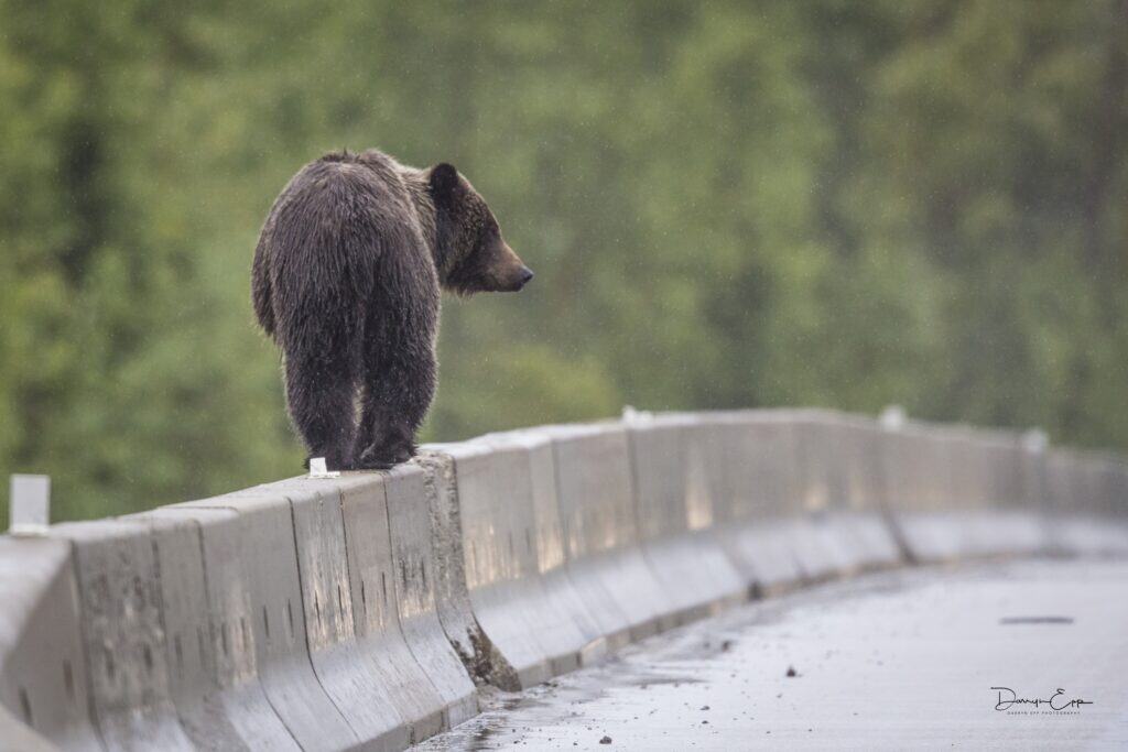
Coal mines, roads and geographic features like steep hills and valleys influence the ways that grizzly bears use the land—and respond to human presence—in the southern Canadian Rocky Mountains.
With a better understanding of how various features on the landscape affect bears, land managers can make better decisions about maintaining or building wildlife connectivity.
“The local context of where bears are—the surrounding local area—changes the ways they behave in different scenarios,” said Eric Palm, a postdoctoral researcher at Michigan State University.
In past studies, researchers had surveyed grizzly bear (Ursus arctos horribilis) movements in the southern Rocky Mountains of Alberta and British Columbia using GPS devices. Together, these studies had tracked the movements of the bears across 85,000 square kilometers.
In a study published recently in Conservation Science and Practice, Palm and his colleagues tested how these movements were influenced by human landscape features like roads, towns and coal mines, along with geographical features like valleys and steep mountains.
The results revealed a more accurate map of how grizzlies move on the landscape—and what they typically avoid.
For example, the Bow River Valley that goes through Banff National Park is quite steep, and the surrounding forested slopes lack good bear food. As a result, bears are more likely to move through the valley bottoms where food is concentrated in open areas along the Trans-Canada Highway and other roads that cut through the area.
In contrast, much gentler slopes with plenty of meadows surround the Elk River Valley, east of Jasper National Park. “There is more food [for bears] in general,” said Palm, a researcher at the University of Montana and the University of British Columbia Okanagan at the time. In this case, grizzlies tend to avoid highways and other places with humans because they have plenty of more remote opportunities.
Coal mines spell trouble
The analysis revealed that unless they are forced into areas with coal mines—of which there are several in the southern Rockies—bears typically choose to avoid these areas. Palm said this is important information, since the Alberta provincial government recently lifted a moratorium on new coal mines and several proposed mines in British Columbia are moving forward. “It doesn’t seem like they are slowing down [either] in building new mines [or] expanding old ones,” he said.
Using the approach that Palm’s team developed, managers—if they so choose—could simulate how these developments might change bear movements under different future scenarios, potentially pushing them into highways or settlements and leading to more conflict.
Overall, he hopes that managers can harness this technique to improve connectivity—or at least not break up connectivity too much—for bears when making development plans. “Everyone wants connectivity predictions,” Palm said, referencing the Canadian federal government’s National Program for Ecological Corridors to improve wildlife connectivity.
Palm also hopes that this method gives governments and other stakeholders a more rigorous way to quantify connectivity.
Header Image: Maps revealed what factors may push grizzlies to get closer to roads more often. Credit: Darryn Epp
Related Posts
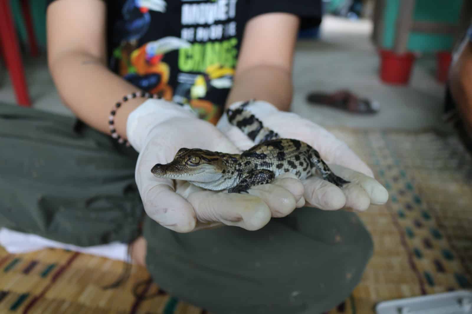
Laos communities bring rare crocodiles back from brink
The Siamese crocodile has suffered massive losses in the past century until recently in Xe Champhone wetlands

LISTEN: Transportation ecology bridges the gap
Wildlife crossings connect landscapes and save lives
Massive wildlife overpass opens in Colorado
Completed in under a year and below budget, the new crossing improves safety