

Share this article
Overhead view of seals reveals dramatic recovery
Using a mix of technology in high places, researchers confirmed that gray seals (Halichoerus grypus) off the coast of New England and eastern Canada have recovered over the past 45 years, and in the U.S. they’re reaching much higher numbers than previous counts — using more traditional methods — had revealed.
These eyes in the sky included a combination of drones, thermal imaging cameras and Google Earth images.
“That’s what’s so remarkable about life. It’s very resilient and powerful,” said David Johnston, the senior author on two papers on the species’ recovery — one published in Scientific Reports in March and another published in June in BioScience. “Sometimes all you have to do is stop doing the bad things, and it gets better.”
Hunted for their meat and pelts and eliminated for were preying on fishing stocks, the seals had declined to only 30 individuals along the coast of Maine by 1973. After the 1972 passage of the Marine Mammal Protection Act, which made it illegal to harass and kill the animals, their numbers rebounded.
Past counts using traditional methods reported the seals had reached populations of 15,000 to 20,000. The latest studies estimated the seal populations at 30,000 to 50,000.
“The traditional method would be to use fixed-wing aircraft with expensive cameras, which is costly and logistically complex, or using a helicopter to shoot oblique photos,” Johnston said.
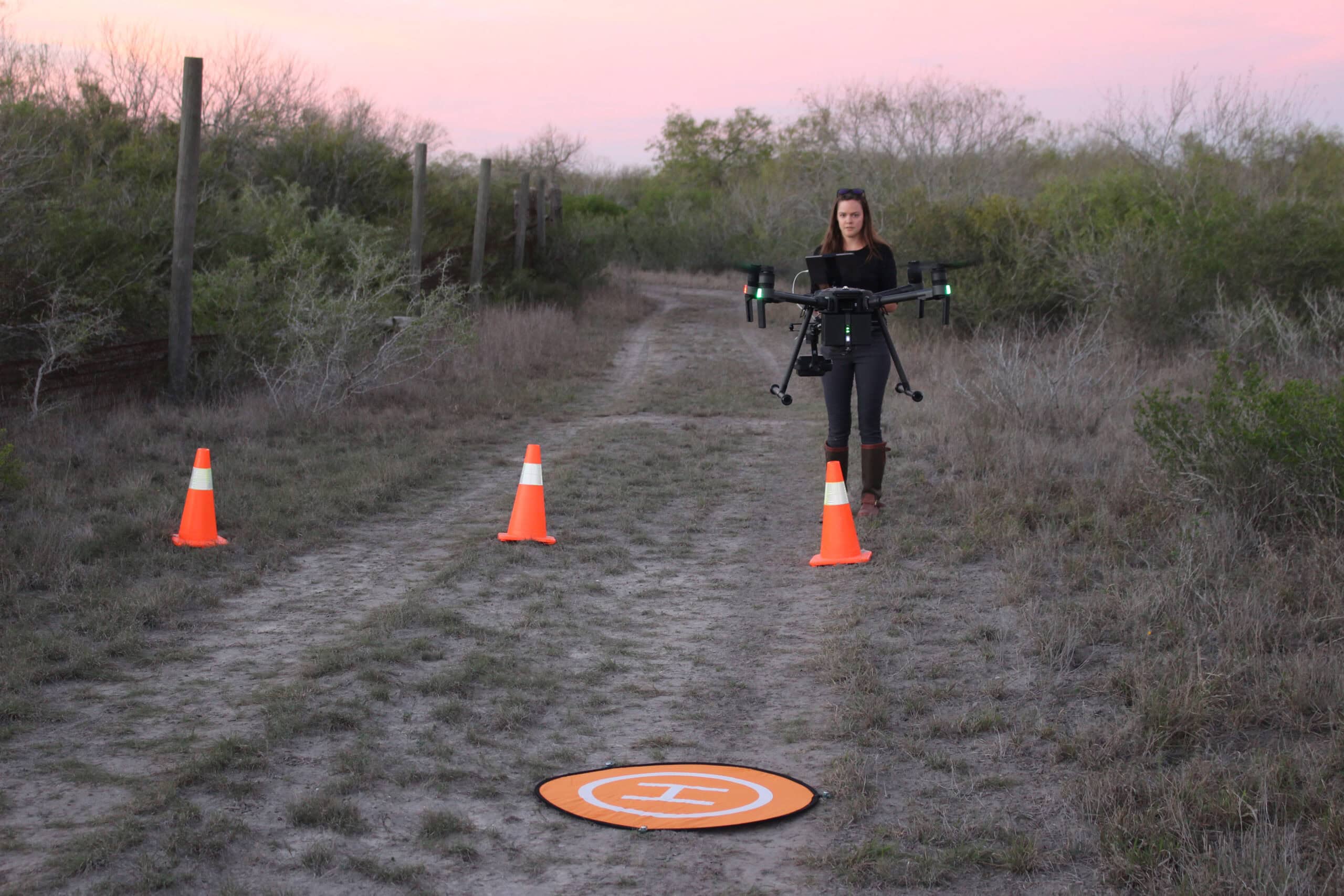
Instead, in the first study, Johnston and his team worked with the Canadian Department of Fish and Oceans to conduct aerial surveys of gray seal populations on Nova Scotia’s Hay Island and Saddle Island using drones equipped with thermal imaging technology — a much cheaper alternative.
The team created a computer algorithm to count adult seals and pups based on their heat signatures from thermal images taken from drones. They were even able to detect seals hiding behind vegetation or blending in with their surroundings, Johnston said. The researchers then counted the individual seals in the photos for comparison. They found that the counts using the computer algorithm were less than 5 percent different than the human-counted ones.
“It’s nice to be able to use this technique to reduce some of the costs,” Johnston said. “It could be important for groups of people that might not have the kind of money to buy an aircraft.”
Preliminary research shows the drones don’t disturb the seals, Johnston said. At the height they’re flying, drones are undetectable by gray seals, he said, and their silhouettes are smaller than eagles’, which commonly fly around the colony.
“They wouldn’t be visually disturbed by birds in the sky,” he said.
In a second study published in BioScience, Johnston and his colleagues used free images from Google Earth to estimate seal populations on the New England coast.
“In the last 20 years, we’ve seen their populations recover,” Johnston said. “We watched those animals come back, but there was no abundance estimate. This novel use of Google Earth allowed us to generate that.”
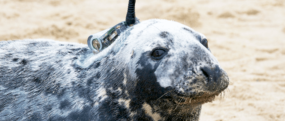
The team had also tagged the seals to determine haul-out patterns, when the seals leave the water, so they could estimate the proportion of animals not on the beach where the images were taken.
“I think the most important thing is we can generate relatively high quality data that is unique and less costly and less risky for people,” Johnston said. “Seeing this move toward using robotic technology and satellites already, I expect them to become more and more important tools in a biologists’ toolbox over time.”

Header Image: A seal is fitted with a GPS tag that was used in conjunction with Google Earth images to determine an abundance count of the population off the New England coast. ©Duke Marine Robotics and Remote Sensing
Related Posts
WSB: Study tests accuracy of thermal drone surveys
In South Texas, the heat can be blinding
Computer model explores Tribal use of fire for ecosystem health
The Karuk Tribe regularly conducted burns in the fire-prone Klamath Mountains

2024 TWS Elections: Southwest Representative
This year’s nominees for Southwest Representative to TWS Council are Kathy Granillo and Erika Nowak