
Oil and gas exploration in Alaska’s North Slope would disturb fewer maternal denning polar bear mothers if start times are delayed during bear maternal denning periods and if den distribution is considered.
Seismic surveying is a technique for discovering underground oil and gas deposits. In this part of Alaska, energy companies locate oil and gas deposits by using a large specialized truck that drives along the landscape pounding the ground with special equipment, analyzing how the sound reverberates.
In Alaska, this technique typically only works in the winter when the snow is hard-packed. Once snow begins to melt, there are restrictions about damaging tundra that’s no longer sitting under a protective layer of snow.
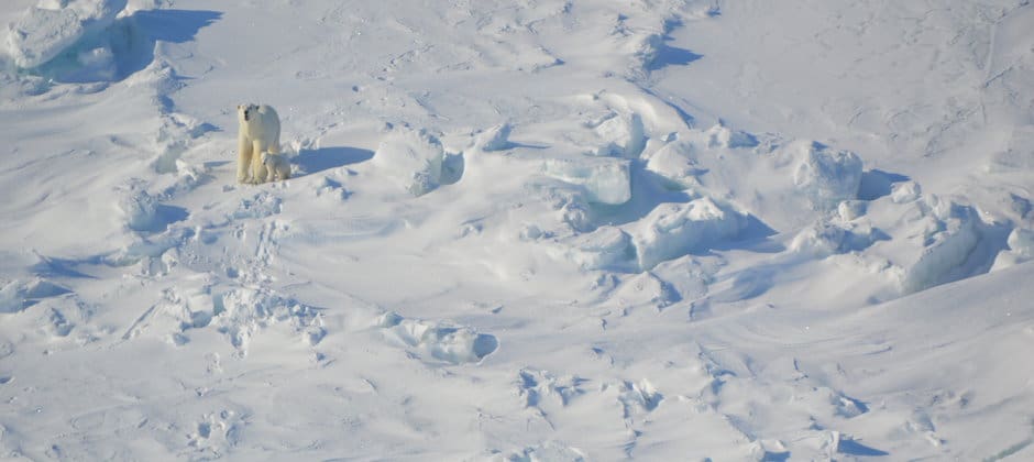
The trouble is, in the northeastern corner of the Arctic National Wildlife Refuge, which has oil and gas deposits, seismic surveys are proposed in a coastal region where it is calculated 20 maternal polar bear may build their dens under the snow for the winter.
The seismic companies work with the U.S. Fish and Wildlife Service to conduct their work in ways that least impact marine mammals like polar bears.
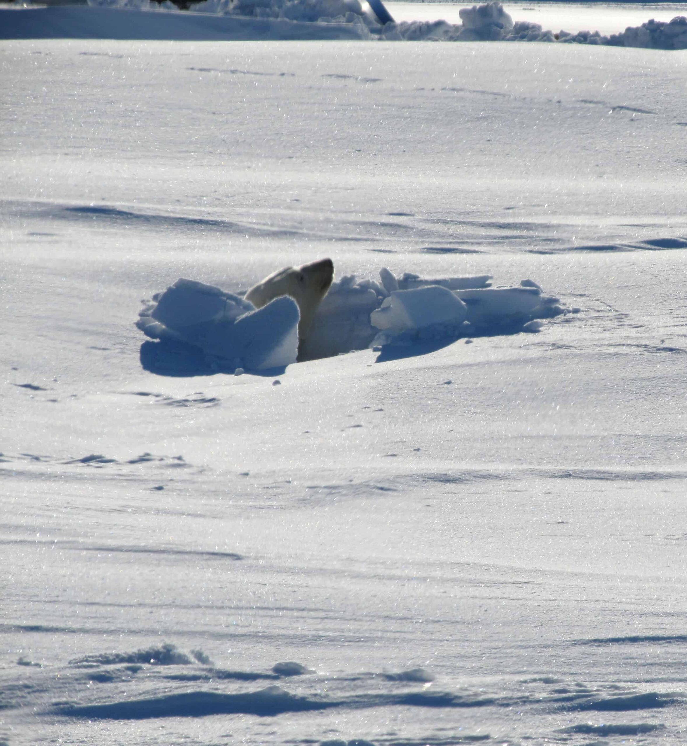
“The density of denning in this area is the highest of any area in Alaska for this polar bear population,” said TWS member Ryan Wilson, a U.S. Fish and Wildlife biologist in the polar bear program and the lead author of a study published in the Journal of Wildlife Management.
Wilson and his co-author, U.S. Geological Survey researcher and TWS member George Durner, developed models to examine how different seismic exploration scenarios affect polar bear dens.
They found the situation that worked best was to run seismic surveys over two years, delaying the start of operations both years, which allowed a greater number of bears a chance to emerge from maternal dens prior to operations occurring near them. That scenario led to a 90% predicted drop in polar bear disturbances compared to a model in which the oil and gas industry didn’t take into account where bear dens were when timing where to conduct surveys.
The industry commonly uses aerial surveys to spot dens, or at least predict where they are most likely to be. But even when Wilson and Durner ran models that included this data, they still didn’t limit disturbance as much as when the surveys were split up over two years with the delayed start time.
Wilson said that the findings of these models could likely be expanded for other types of disturbance such as ice roads, also used in the oil and gas industry. They could be used to assess the risk of a given ice road on disturbing polar bear dens, and help to plan where and when their development might have the least impact. While this study doesn’t specifically look at these operations, he said that it could be used as a starting point for interactions with the industry regarding the best ways to minimize polar bear disturbance.
This article features research that was published in a TWS peer-reviewed journal. Individual online access to all TWS journal articles is a benefit of membership. Join TWS now to read the latest in wildlife research.
Article by Joshua Rapp Learn