


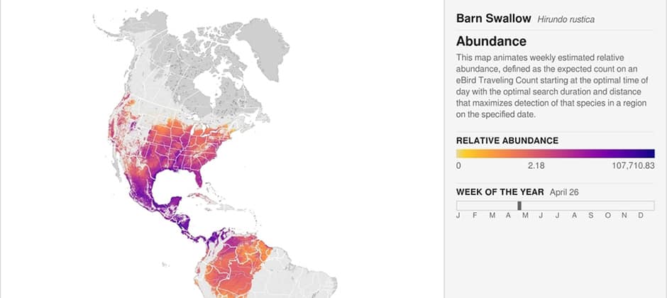
The Cornell Lab of Ornithology’s eBird program has released 500 animated maps showing bird occupation and movement across the western hemisphere. The maps merge millions of observations from bird watchers with NASA satellite images to show where hundreds of species travel and how their numbers vary across time and distance. “This type of spatial and temporal information helps guide more flexible conservation solutions that can more readily accommodate human and ecological needs,” said Amanda Rodewald, the Garvin Professor and co-director of the Center for Avian Population Studies at the Cornell Lab.
The maps are publicly available for researchers, educators and conservationists.
Read more from the Cornell Chronicle.
Article by The Wildlife Society